MyTopo
Souse Springs New Mexico US Topo Map
Couldn't load pickup availability
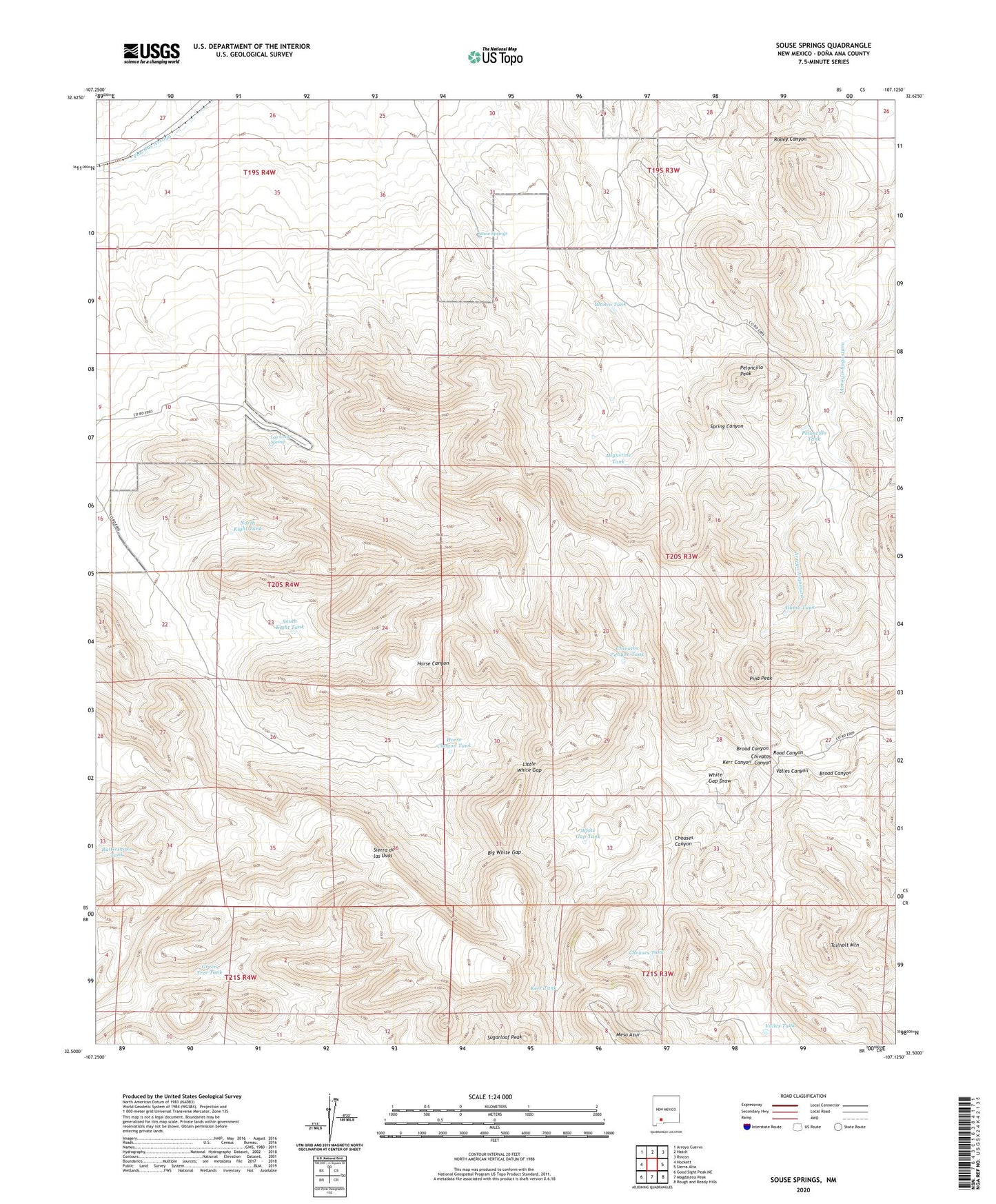
2023 topographic map quadrangle Souse Springs in the state of New Mexico. Scale: 1:24000. Based on the newly updated USGS 7.5' US Topo map series, this map is in the following counties: Doña Ana. The map contains contour data, water features, and other items you are used to seeing on USGS maps, but also has updated roads and other features. This is the next generation of topographic maps. Printed on high-quality waterproof paper with UV fade-resistant inks.
Quads adjacent to this one:
West: Hockett
Northwest: Arroyo Cuervo
North: Hatch
Northeast: Rincon
East: Sierra Alta
Southeast: Rough and Ready Hills
South: Magdalena Peak
Southwest: Good Sight Peak NE
This map covers the same area as the classic USGS quad with code o32107e2.
Contains the following named places: Alamo Tank, Alamo Windmills, Augustine Tank, Big White Gap, Blanco Tank, Chivatos Canyon, Chivatos Canyon Tank, Choases Canyon, Choases Tank, Escondido Ranch, Green Tree Tank, Horse Canyon Ranch, Horse Canyon Tank, Kerr Canyon, Kerr Tank, Las Uvas Mountains Wilderness Study Area, Las Uvas Ranch, Las Uvas Spring, Little White Gap, Middle Ranch Windmill, North Kight Tank, Peloncillo Peak, Peloncillo Tank, Pina Peak, Rattlesnake Tank, Road Canyon, Souse Springs, South Kight Tank, Sugarloaf Peak, Tailholt Mountain, Valles Canyon, Valles Tank, White Gap Draw, White Gap Tank, ZIP Code: 87937