
MyTopo
Guadalupe Spring New Mexico US Topo Map
Couldn't load pickup availability
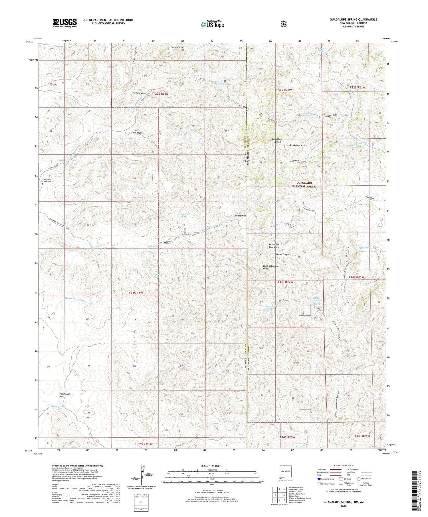
2020 topographic map quadrangle Guadalupe Spring in the states of Arizona, New Mexico. Scale: 1:24000. Based on the newly updated USGS 7.5' US Topo map series, this map is in the following counties: Hidalgo, Cochise. The map contains contour data, water features, and other items you are used to seeing on USGS maps, but also has updated roads and other features. This is the next generation of topographic maps. Printed on high-quality waterproof paper with UV fade-resistant inks.
Quads adjacent to this one:
West: Million Dollar Tank
Northwest: Paramore Crater
North: Skeleton Canyon
Northeast: Clanton Draw
East: Black Point
Southeast: Guadalupe Pass
South: Guadalupe Canyon
Southwest: West of Guadalupe Canyon
Contains the following named places: Baker Spring, Blackwater Hole, Buck Robinson Wilderness Study Area, Bunk Robinson Peak, Bunk Robinson Spring, Casper Spring Tank, Cedar Spring, Cedar Tank, Cottonwood Creek Cemetery, Cowboy Flat, Eicks Spring, Estes Canyon, Granite Tank, Guadalupe Mountain, Guadalupe Spring, Hog Canyon, Hog Canyon Tank, Indian Spring, Ledar Seep, Ledar Spring, Lee Howard Spring, Line V Seven Ranch, Lion Creek, Little Bunk Robinson Spring, Maverick Spring, McDonald Ranch, Miller Creek, Outlaw Mountain, Pickhandle Hills, Pickhandle Tank, Prospect Tank, Silvertip Mine, Swaggart Spring, Taylor Ranch


