MyTopo
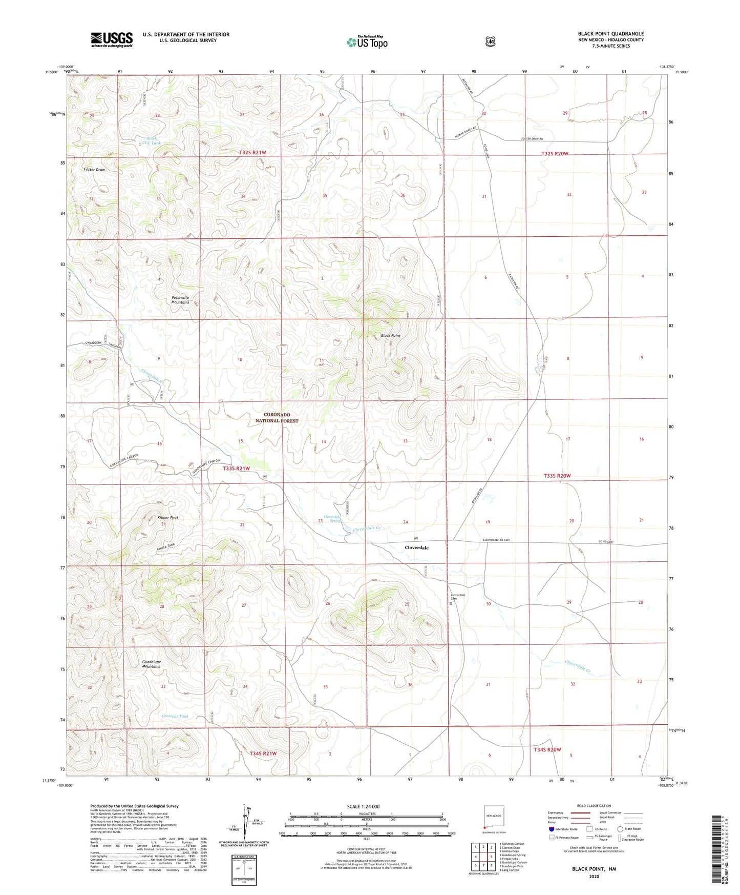
Black Point New Mexico US Topo Map
Couldn't load pickup availability
Also explore the Black Point Forest Service Topo of this same quad for updated USFS data
2023 topographic map quadrangle Black Point in the state of New Mexico. Scale: 1:24000. Based on the newly updated USGS 7.5' US Topo map series, this map is in the following counties: Hidalgo. The map contains contour data, water features, and other items you are used to seeing on USGS maps, but also has updated roads and other features. This is the next generation of topographic maps. Printed on high-quality waterproof paper with UV fade-resistant inks.
Quads adjacent to this one:
West: Guadalupe Spring
Northwest: Skeleton Canyon
North: Clanton Draw
Northeast: Animas Peak
East: Fitzpatricks
Southeast: Lang Canyon
South: Guadalupe Pass
Southwest: Guadalupe Canyon
This map covers the same area as the classic USGS quad with code o31108d8.
Contains the following named places: Bills Tank, Black CCC Tank, Black Mountain Tank, Black Point, Buckhorn Tank, Caldwell Tank, Chuck Tank, Cloverdale, Cloverdale Cemetery, Cloverdale Creek, Cloverdale Park Historic Site, Cloverdale Spring, Cordy Cowan Tank, Cowan Tank, Crescent Tank, Eicks Ranch, Horse Pasture Tank, Hunt Tank, Kilmer Peak, LA 54036, Mesquite Tank, Pendleton Historic Site, Pendleton Ranch, Robertson Ranch, Sanford Tank, Stewart Ranch Site, Sumac Tank, Walnut Gate Tank, Windy Miller Tank, Windy Point Tank