MyTopo
Hermanas New Mexico US Topo Map
Couldn't load pickup availability
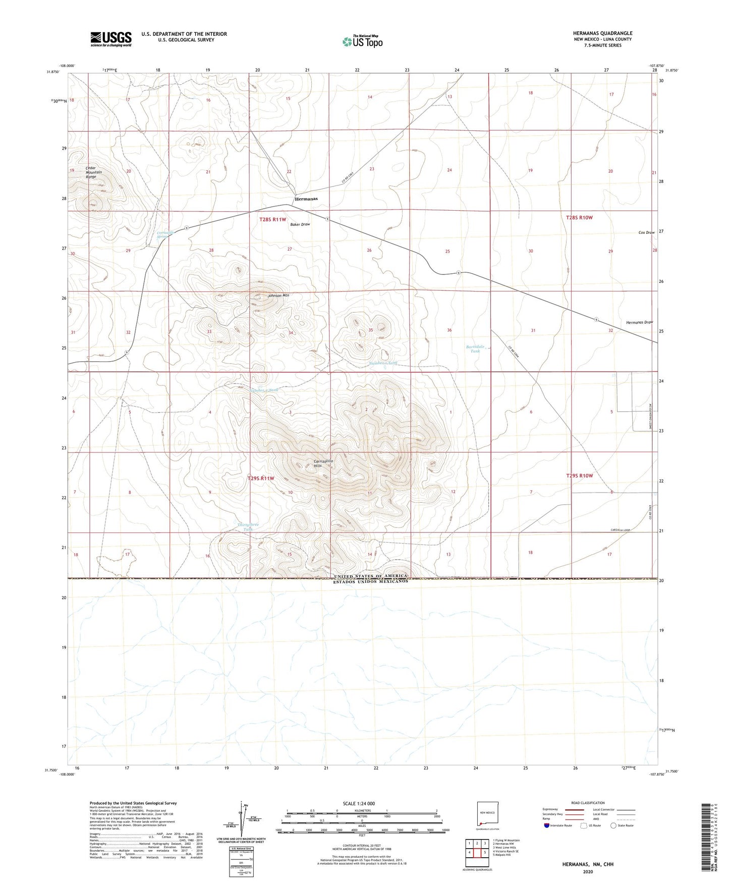
2020 topographic map quadrangle Hermanas in the state of New Mexico. Scale: 1:24000. Based on the newly updated USGS 7.5' US Topo map series, this map is in the following counties: Luna. The map contains contour data, water features, and other items you are used to seeing on USGS maps, but also has updated roads and other features. This is the next generation of topographic maps. Printed on high-quality waterproof paper with UV fade-resistant inks.
Quads adjacent to this one:
West: Victorio Ranch SE
Northwest: Flying W Mountain
North: Hermanas NW
Northeast: West Lime Hills
East: Malpais Hill
Contains the following named places: 01137 Water Well, 01138 Water Well, 01139 Water Well, 01140 Water Well, 01143 Water Well, 01144 Water Well, 01145 Water Well, 01147 Water Well, 01148 Water Well, 01163 Water Well, 01166 Water Well, 01167 Water Well, 01651 Water Well, 01652 Water Well, 01653 Water Well, 01654 Water Well, 01655 Water Well, 01659 Water Well, 10421 Water Well, 10436 Water Well, Baker Draw, Bartsdale Tank, Calumet, Calumet Mine, Carrizalillo Hills, Corrizalillo Spring, Crowville Windmill, Hermanas, Hermanas Post Office, Hermanas Weather Station, Johnson Mountain, Johnson Ranchhouse Section Thirty Three Prospect, Johnson Ranchhouse Section Twenty Eight Prospect, Lower Corral, Midway Windmill, Number 1 Tank, Number 2 Tank, Schoolhouse Windmill, Scott Windmill, Thirtythree Tank