MyTopo
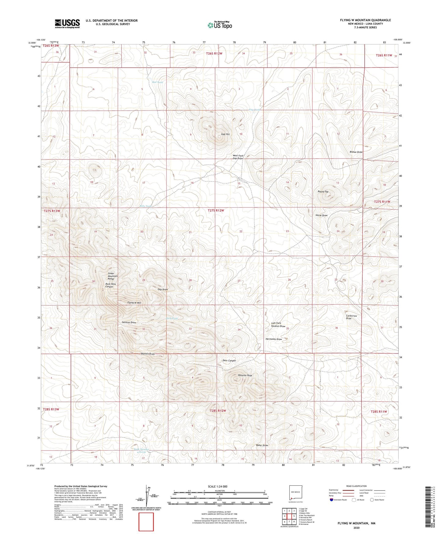
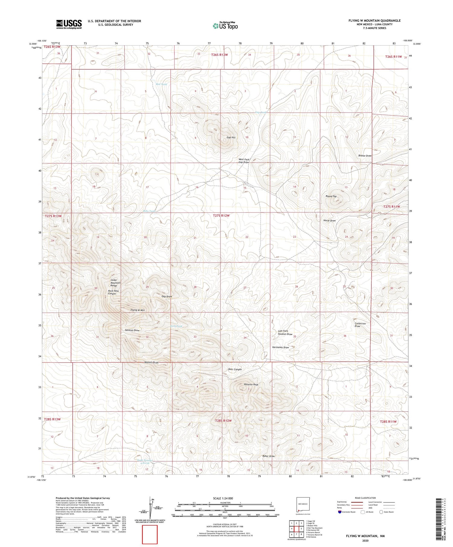
Flying W Mountain New Mexico US Topo Map
Couldn't load pickup availability
2023 topographic map quadrangle Flying W Mountain in the state of New Mexico. Scale: 1:24000. Based on the newly updated USGS 7.5' US Topo map series, this map is in the following counties: Luna. The map contains contour data, water features, and other items you are used to seeing on USGS maps, but also has updated roads and other features. This is the next generation of topographic maps. Printed on high-quality waterproof paper with UV fade-resistant inks.
Quads adjacent to this one:
West: Hat Top Mountain
Northwest: Gage SW
North: Gage SE
Northeast: Bisbee Hills
East: Hermanas NW
Southeast: Hermanas
South: Victorio Ranch SE
Southwest: Victorio Ranch
This map covers the same area as the classic USGS quad with code o31108h1.
Contains the following named places: 01637 Water Well, Bobs Tank, Burdick, Cedar Mountain Range, Deer Canyon, Flying W Mountain, Flying W Ranch, Gap Hill, Gap Tank, Indian Wells, Left Fork Sacaton Draw, North Tank, Palomas Red Hill Dam, Red Tank, Rock Tank, Round Top, Tank Number 4 North, Valiente Peak, Valiente Well, West Fork Gap Draw