MyTopo
Hobbs East New Mexico US Topo Map
Couldn't load pickup availability
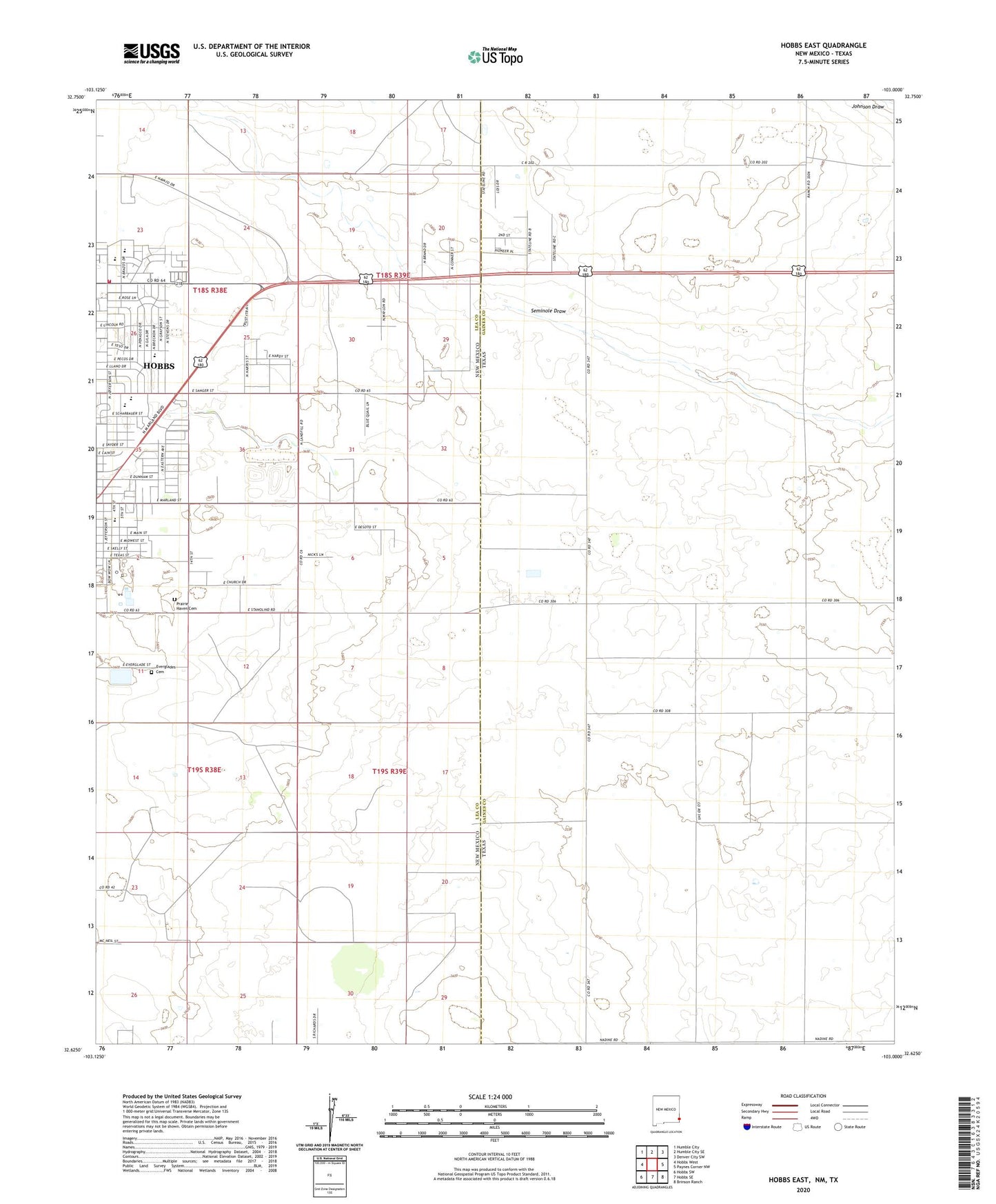
2023 topographic map quadrangle Hobbs East in the states of Texas, New Mexico. Scale: 1:24000. Based on the newly updated USGS 7.5' US Topo map series, this map is in the following counties: Lea, Gaines. The map contains contour data, water features, and other items you are used to seeing on USGS maps, but also has updated roads and other features. This is the next generation of topographic maps. Printed on high-quality waterproof paper with UV fade-resistant inks.
Quads adjacent to this one:
West: Hobbs West
Northwest: Humble City
North: Humble City SE
Northeast: Denver City SW
East: Paynes Corner NW
Southeast: Brinson Ranch
South: Hobbs SE
Southwest: Hobbs SW
Contains the following named places: Booker T Washington Elementary School, Coronado Elementary School, Eagle Stadium, East Hobbs Oil Field, Everglades Cemetery, Highland Middle School, Hobbs Fire Department Station 2, Jefferson Saint Church, KHFT-TV (Hobbs), KKEL-AM (Hobbs), Prairie Haven Cemetery, State Line, Taylor Elementary School, Taylor Memorial Church, Washington Park