MyTopo
Indian Bluff New Mexico US Topo Map
Couldn't load pickup availability
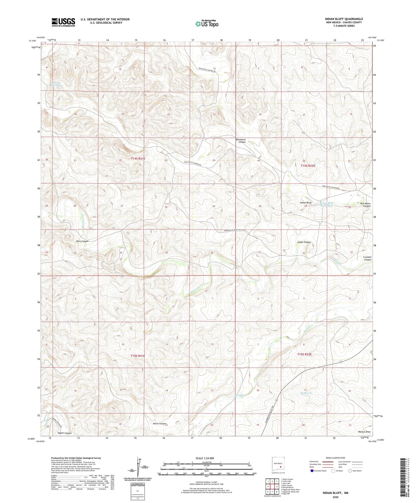
2023 topographic map quadrangle Indian Bluff in the state of New Mexico. Scale: 1:24000. Based on the newly updated USGS 7.5' US Topo map series, this map is in the following counties: Chaves. The map contains contour data, water features, and other items you are used to seeing on USGS maps, but also has updated roads and other features. This is the next generation of topographic maps. Printed on high-quality waterproof paper with UV fade-resistant inks.
Quads adjacent to this one:
West: Dark Canyon
Northwest: Skunk Canyon
North: Lucky Lake
Northeast: Juan Lake
East: Kincaid Ranch
Southeast: Hope NW
South: Sagebrush Valley East
Southwest: Sagebrush Valley West
This map covers the same area as the classic USGS quad with code o33104a7.
Contains the following named places: 10476 Water Well, Cedar Canyon, Cedar Well, Crooked Creek Well, Dark Canyon, Gressett Water Hole, Horse Canyon, Horse Canyon Well, Indian Bluff, Indian Bluff Water Hole, McGee Ranch, Monument Canyon, Rattlesnake Well, Twin Butte Camp, Waller Ranch