MyTopo
Jal New Mexico US Topo Map
Couldn't load pickup availability
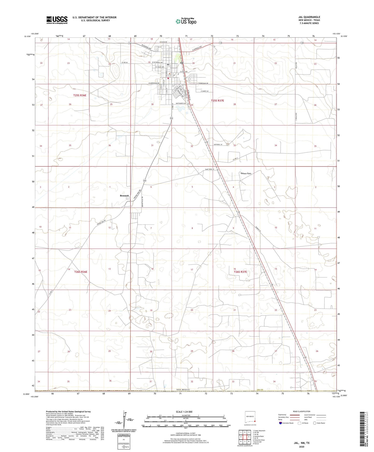
2023 topographic map quadrangle Jal in the state of New Mexico. Scale: 1:24000. Based on the newly updated USGS 7.5' US Topo map series, this map is in the following counties: Lea, Winkler. The map contains contour data, water features, and other items you are used to seeing on USGS maps, but also has updated roads and other features. This is the next generation of topographic maps. Printed on high-quality waterproof paper with UV fade-resistant inks.
Quads adjacent to this one:
West: Javelina Basin
Northwest: Custer Mountain
North: Jal NW
Northeast: Jal NE
East: Jal SE
Southeast: Vesrue
South: Kermit NW
Southwest: Cheyenne Draw
Contains the following named places: Bennett, Bennett Post Office, Burke Junior High School, Calvary Baptist Church, Church of Christ, Church of God, City of Jal, Fifth Street Baptist Church, First Assembly of God Church, First Baptist Church, Jal, Jal Cemetery, Jal Clinic, Jal Elementary School, Jal Emergency Medical Services, Jal High School, Jal Junior / Senior High School, Jal Post Office, Jal Spanish Baptist Church, Jal Volunteer Fire Department, Jal Weather Station, KPEQ-FM (Jal), Lea County Road Department Pit, Toboso Flats