MyTopo
La Cinta Mesa New Mexico US Topo Map
Couldn't load pickup availability
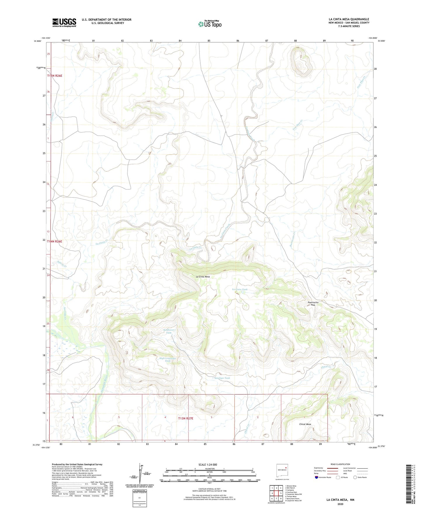
2020 topographic map quadrangle La Cinta Mesa in the state of New Mexico. Scale: 1:24000. Based on the newly updated USGS 7.5' US Topo map series, this map is in the following counties: San Miguel. The map contains contour data, water features, and other items you are used to seeing on USGS maps, but also has updated roads and other features. This is the next generation of topographic maps. Printed on high-quality waterproof paper with UV fade-resistant inks.
Quads adjacent to this one:
West: Conchas Dam
Northwest: Minese Mesa
North: Bell Ranch
Northeast: Campana
East: Carpenter Mesa NW
Southeast: Carpenter Mesa SW
South: Monument Point
Southwest: Tenaja Mesa
Contains the following named places: Antelope Tank, Bench Windmill, Bull Pasture Windmill, Chical Mesa, Conchas Dam Division, Cow Pass Creek, Hardluck Windmill, High Lonesome Tank, Indian Rock Windmill, La Cinta Creek, La Cinta Creek Windmill, La Cinta Mesa, La Cinta Tank, New La Cinta Windmill, Old La Cinta Windmill, Pablo Montoya Grant, Puertocito Creek, Puertocito Pass, Puertocito Windmills, Red Tower Windmill, Sabinosa Windmill, Sand Ridge Windmill, South Gavilan Windmill, Sunflower Tank, Tulosa Creek, Upper Chical Windmill