MyTopo
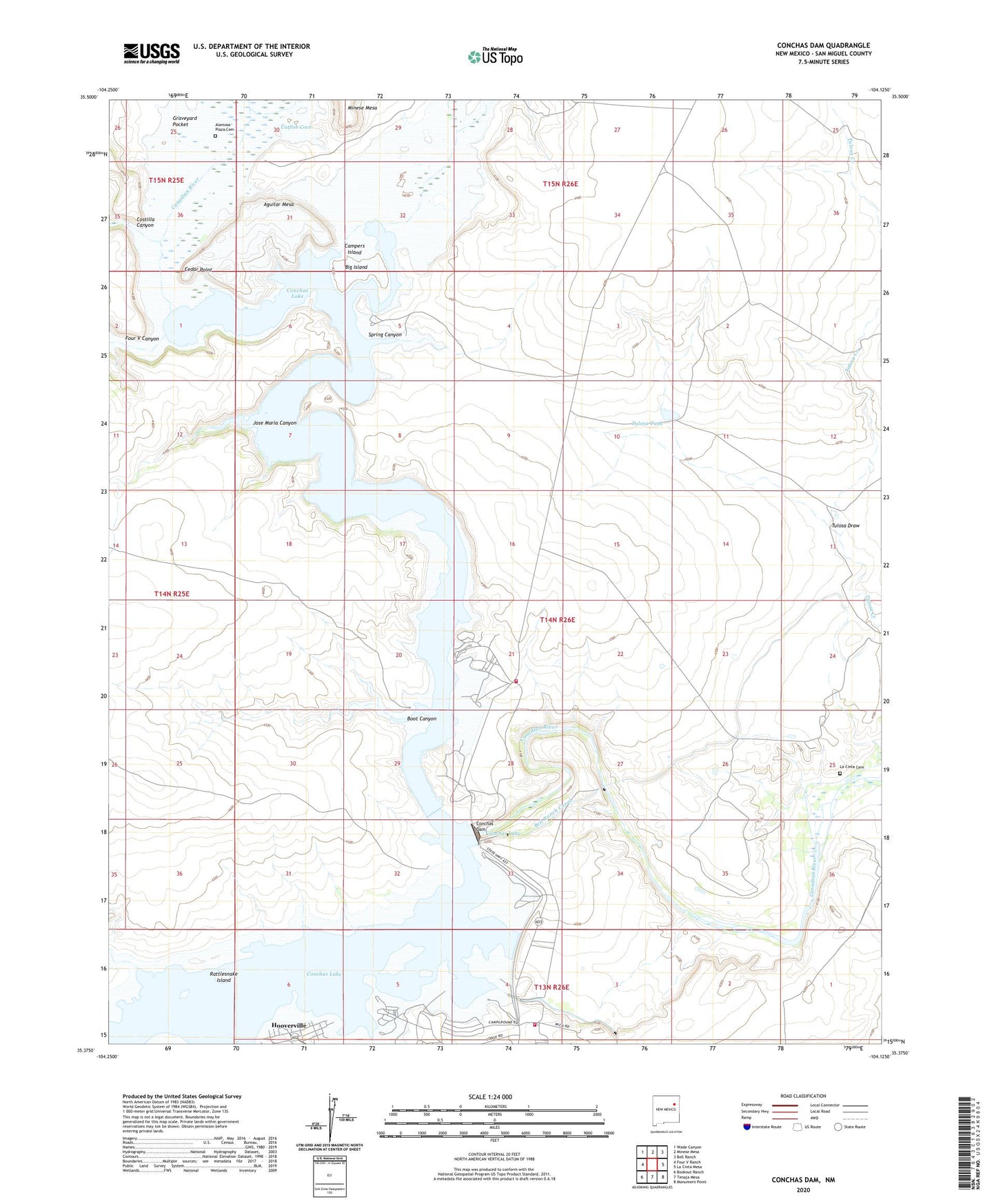
Conchas Dam New Mexico US Topo Map
Couldn't load pickup availability
2023 topographic map quadrangle Conchas Dam in the state of New Mexico. Scale: 1:24000. Based on the newly updated USGS 7.5' US Topo map series, this map is in the following counties: San Miguel. The map contains contour data, water features, and other items you are used to seeing on USGS maps, but also has updated roads and other features. This is the next generation of topographic maps. Printed on high-quality waterproof paper with UV fade-resistant inks.
Quads adjacent to this one:
West: Four V Ranch
Northwest: Wade Canyon
North: Minese Mesa
Northeast: Bell Ranch
East: La Cinta Mesa
Southeast: Monument Point
South: Tenaja Mesa
Southwest: Bookout Ranch
This map covers the same area as the classic USGS quad with code o35104d2.
Contains the following named places: Aguilar Mesa, Alamosa Plaza Cemetery, Bell Ranch Canal, Bell Ranch Headquarters Historic Site, Big Island, Boot Canyon, Campers Island, Cannon Air Force Base Recreation Area, Catfish Cove, Cedar Point, Clabber Hill Ranch, Conchas Aquatic Camp, Conchas Baptist Mission, Conchas Dam, Conchas Dam Fire / Rescue Station 2, Conchas Dam Post Office, Conchas Dam Weather Station, Conchas Lake, Conchas Lake Seaplane Base, Conchas Lake State Park, Conchas School, Costilla Canyon, Four V Canyon, Graveyard Pocket, Hooverville, Jose Maria Canyon, La Cinta, La Cinta Cemetery, La Cinta Post Office, North Dock, Rattlesnake Island, San Miguel County Fire District Conchas Dam Fire and Rescue Station 3, South Dock, Spring Canyon, Tulosa Draw, Tulosa Tank, Tulosa Windmill