MyTopo
La Mesita Negra SE New Mexico US Topo Map
Couldn't load pickup availability
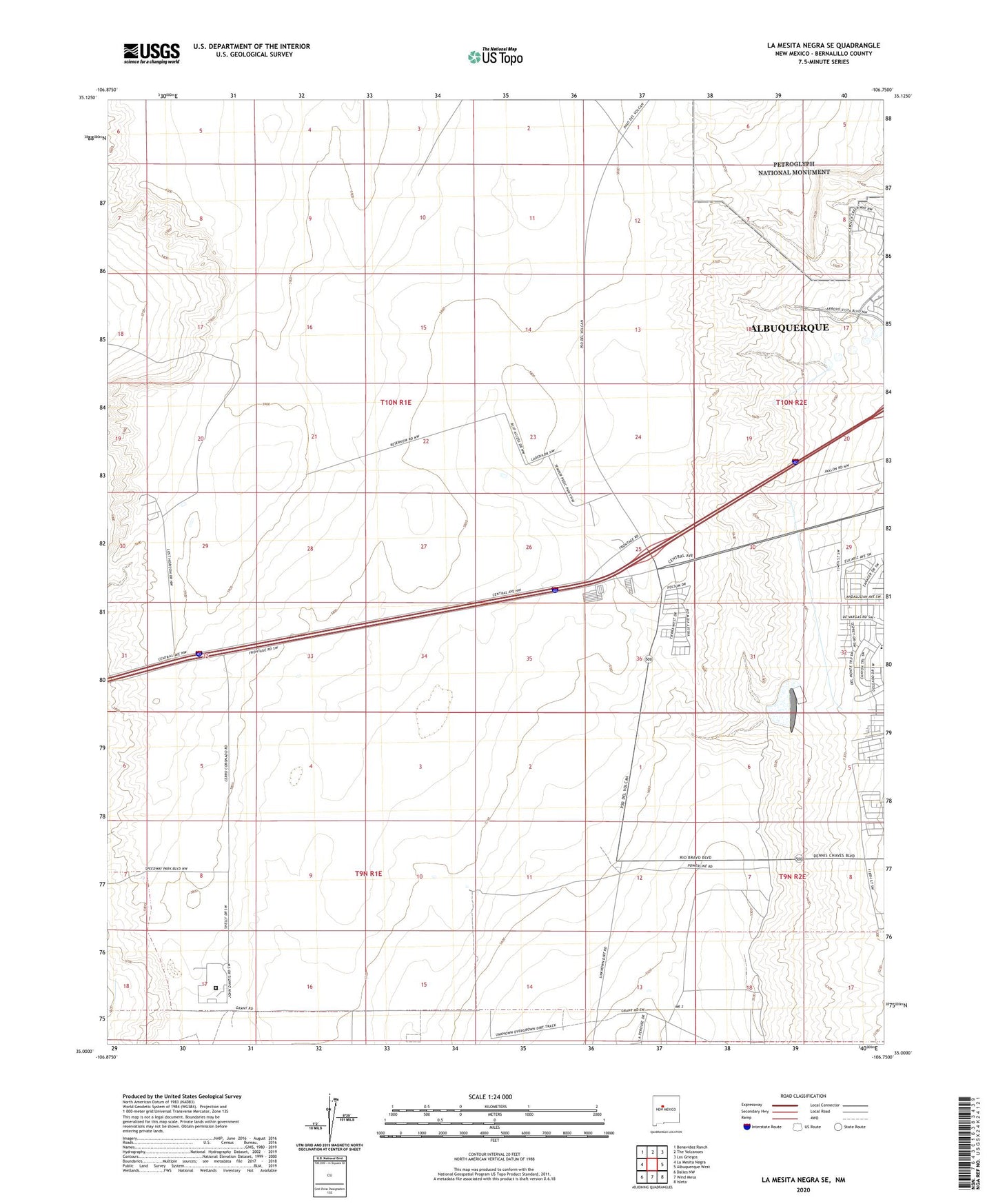
2020 topographic map quadrangle La Mesita Negra SE in the state of New Mexico. Scale: 1:24000. Based on the newly updated USGS 7.5' US Topo map series, this map is in the following counties: Bernalillo. The map contains contour data, water features, and other items you are used to seeing on USGS maps, but also has updated roads and other features. This is the next generation of topographic maps. Printed on high-quality waterproof paper with UV fade-resistant inks.
Quads adjacent to this one:
West: La Mesita Negra
Northwest: Benavidez Ranch
North: The Volcanoes
Northeast: Los Griegos
East: Albuquerque West
Southeast: Isleta
South: Wind Mesa
Southwest: Dalies NW
Contains the following named places: 1049 FT PZ Water Well, 1175 FT PZ Water Well, 87121, Albuquerque Fire Department Training Academy, Atrisco Village Park, Carlos Rey Elementary School, Carlos Rey Park, Don Number 1 Water Well, KBBU-FM (Los Lunas), KMYI-FM (Armijo), KWQK-FM (Albuquerque), Metropolitan Detention Center, MW-2 Water Well, MW-3 Water Well, Oncho Grande Water Well, Park Plaza, Quebrar, Town of Atrisco Grant, West Mesa 1 A Water Well