MyTopo
Laguna Gatuna New Mexico US Topo Map
Couldn't load pickup availability
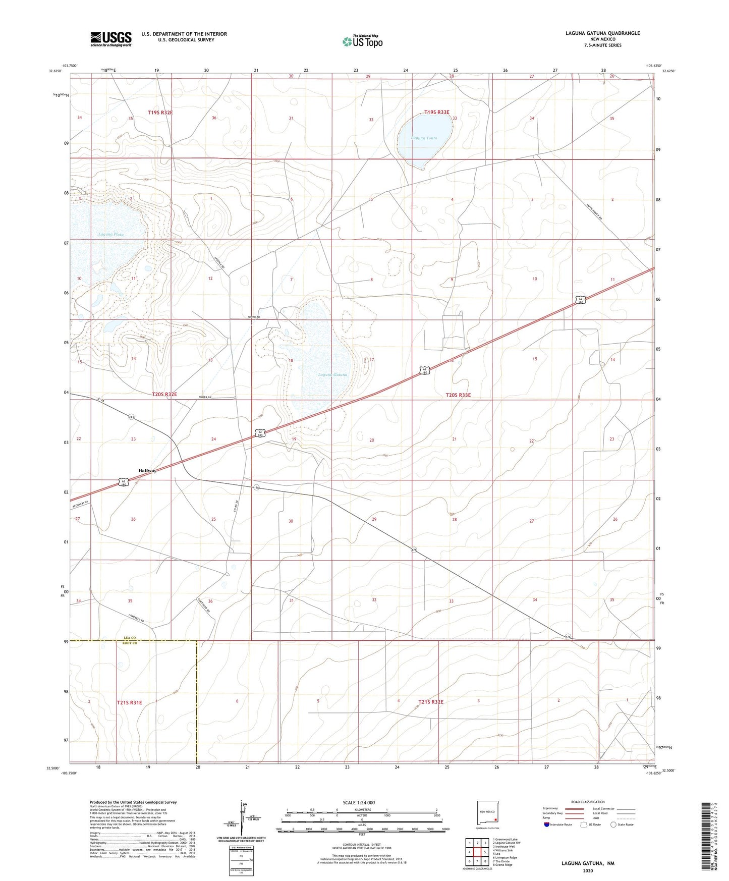
2023 topographic map quadrangle Laguna Gatuna in the state of New Mexico. Scale: 1:24000. Based on the newly updated USGS 7.5' US Topo map series, this map is in the following counties: Lea, Eddy. The map contains contour data, water features, and other items you are used to seeing on USGS maps, but also has updated roads and other features. This is the next generation of topographic maps. Printed on high-quality waterproof paper with UV fade-resistant inks.
Quads adjacent to this one:
West: Williams Sink
Northwest: Greenwood Lake
North: Laguna Gatuna NW
Northeast: Ironhouse Well
East: Lea
Southeast: Grama Ridge
South: The Divide
Southwest: Livingston Ridge
This map covers the same area as the classic USGS quad with code o32103e6.
Contains the following named places: Allred Ranch, Bingham Ranch, Campbell Ranch, Grave Well, Halfway, Hat Mesa Gas Field, Laguna Gatuna, Laguna Tonto, Noranda Prospect, Salt Lake Oil Field, Salt Lake Ranch, South Salt Lake Gas Field, Teas Oil Field, Three Wells Windmill