MyTopo
Lagunitas Creek New Mexico US Topo Map
Couldn't load pickup availability
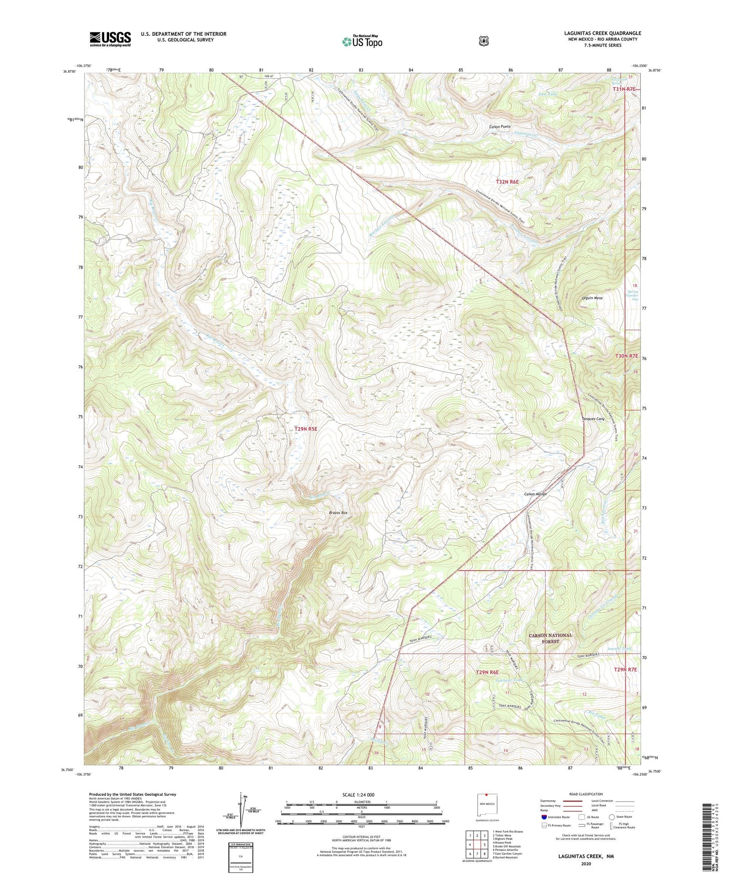
2020 topographic map quadrangle Lagunitas Creek in the state of New Mexico. Scale: 1:24000. Based on the newly updated USGS 7.5' US Topo map series, this map is in the following counties: Rio Arriba. The map contains contour data, water features, and other items you are used to seeing on USGS maps, but also has updated roads and other features. This is the next generation of topographic maps. Printed on high-quality waterproof paper with UV fade-resistant inks.
Quads adjacent to this one:
West: Brazos Peak
Northwest: West Fork Rio Brazos
North: Toltec Mesa
Northeast: Bighorn Peak
East: Broke Off Mountain
Southeast: Burned Mountain
South: East Gavilan Canyon
Southwest: Penasco Amarillo
Contains the following named places: Amado Tank, Bad Lands, Bagwell Cow Camp, Brazos Cow Camp, Canon Manga, Canon Puela, Danny Tank, Discovery Tank, East Tank, El Camino Spring, Gavilan Creek, Jawbone Tank, Murphy Cow Camp, Murphy Tank, Olguin Mesa, Spring Tank, Spring Tank Number Two, Stewart Cow Camp, Thomas Martinez O'Reilly Cow Camp