MyTopo
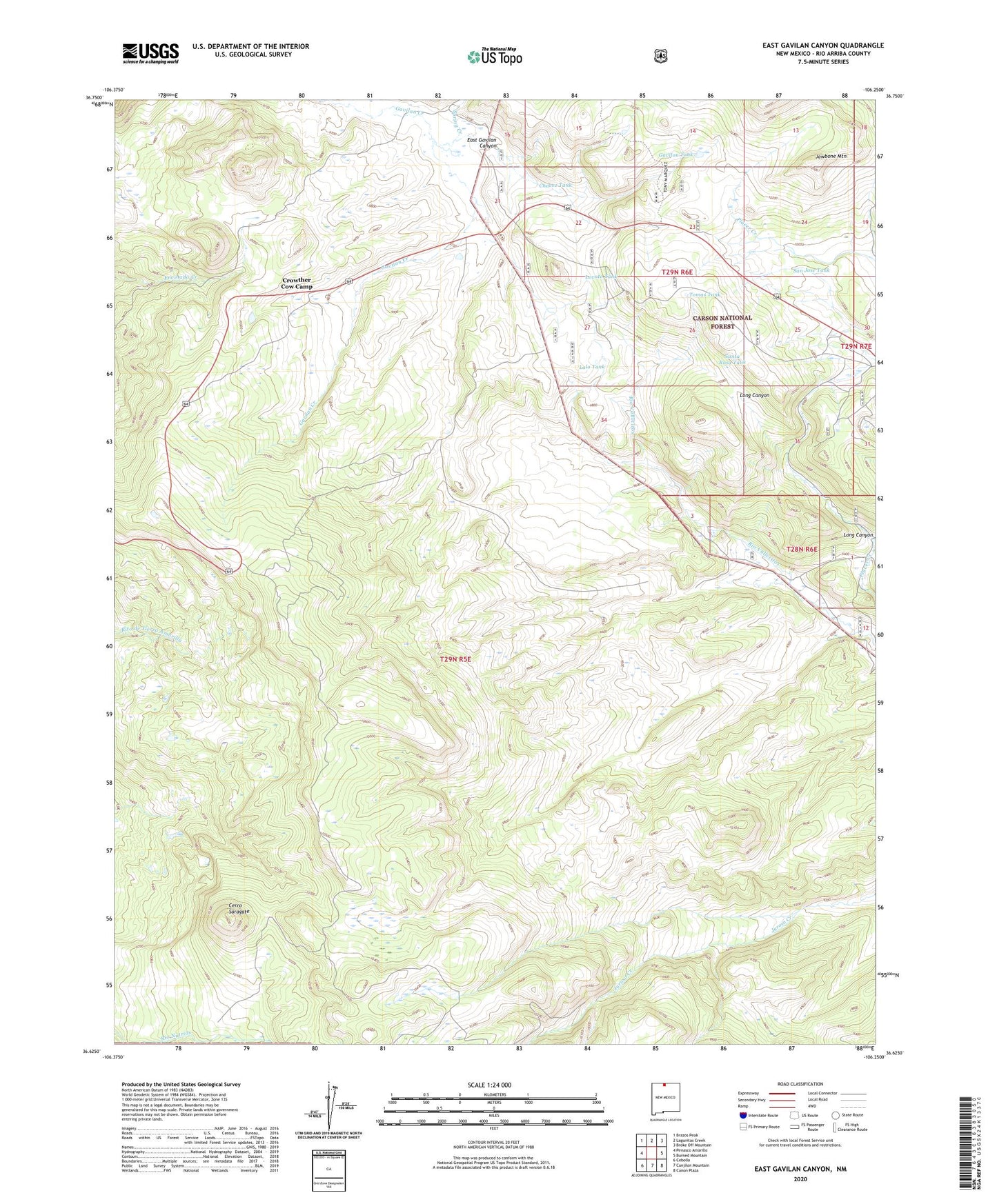
East Gavilan Canyon New Mexico US Topo Map
Couldn't load pickup availability
Also explore the East Gavilan Canyon Forest Service Topo of this same quad for updated USFS data
2023 topographic map quadrangle East Gavilan Canyon in the state of New Mexico. Scale: 1:24000. Based on the newly updated USGS 7.5' US Topo map series, this map is in the following counties: Rio Arriba. The map contains contour data, water features, and other items you are used to seeing on USGS maps, but also has updated roads and other features. This is the next generation of topographic maps. Printed on high-quality waterproof paper with UV fade-resistant inks.
Quads adjacent to this one:
West: Penasco Amarillo
Northwest: Brazos Peak
North: Lagunitas Creek
Northeast: Broke Off Mountain
East: Burned Mountain
Southeast: Canon Plaza
South: Canjilon Mountain
Southwest: Cebolla
This map covers the same area as the classic USGS quad with code o36106f3.
Contains the following named places: Cerro Saragate, Chavez Tank, Crowther Cow Camp, East Gavilan Canyon, Gavilon Tank, Headstone Mine, Hidden Treasure Mine, Hooker Sawmill, Johnson Cow Camp, Lalo Tank, Long Canyon, Lovato Tank, Old Buckhorn Mine, Peterson Cow Camp, San Jose Tank, Santa Rosa Tank, Spring Creek, Tierrra Amarilla Grant Benton, Tomas Tank, ZIP Code: 87575