MyTopo
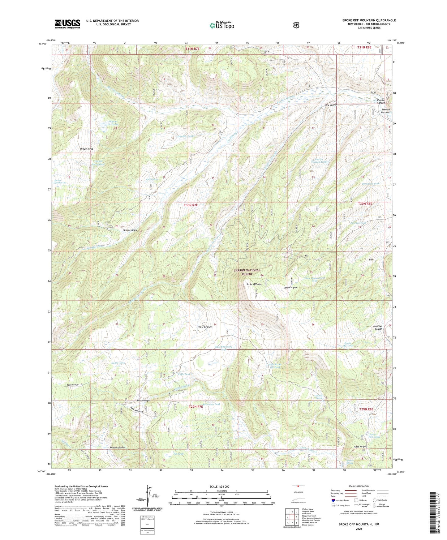
Broke Off Mountain New Mexico US Topo Map
Couldn't load pickup availability
Also explore the Broke Off Mountain Forest Service Topo of this same quad for updated USFS data
2023 topographic map quadrangle Broke Off Mountain in the state of New Mexico. Scale: 1:24000. Based on the newly updated USGS 7.5' US Topo map series, this map is in the following counties: Rio Arriba. The map contains contour data, water features, and other items you are used to seeing on USGS maps, but also has updated roads and other features. This is the next generation of topographic maps. Printed on high-quality waterproof paper with UV fade-resistant inks.
Quads adjacent to this one:
West: Lagunitas Creek
Northwest: Toltec Mesa
North: Bighorn Peak
Northeast: Los Pinos
East: San Antonio Mountain
Southeast: Mule Canyon
South: Burned Mountain
Southwest: East Gavilan Canyon
This map covers the same area as the classic USGS quad with code o36106g2.
Contains the following named places: Alire Tank Number 1, Beehive Spring, Bernardo Tank, Broke Off Mountain, Broke Off Tank, Canada Tio Grande, Cisneros Park Spring, Cisneros Spring, Dry Canyon, Dry Canyon Tank Number Two, Game Department Tank, Julian Draw Tank, La Jara Tank, Lagunitas Creek, Lower Tank, Moeller Tank, Negro Tank, Olguin Mesa Tank, Olguin Pit Tanks, Pit Tank, Placita Canyon, Placito Canyon Tank, Porcupine Tank, Rim Rock Tank, Rincon Apache, Rincon Negro, Rio Nutritas, San Antonio, San Antonio Cabin, Sandoval Tank, Spring Number One, Stewart Meadows, Tanques Canyon, Valle Grande, Valle Tank, Warm Spring, West Boundary Tank, West Broke Off Tank