MyTopo
Lazy E Ranch New Mexico US Topo Map
Couldn't load pickup availability
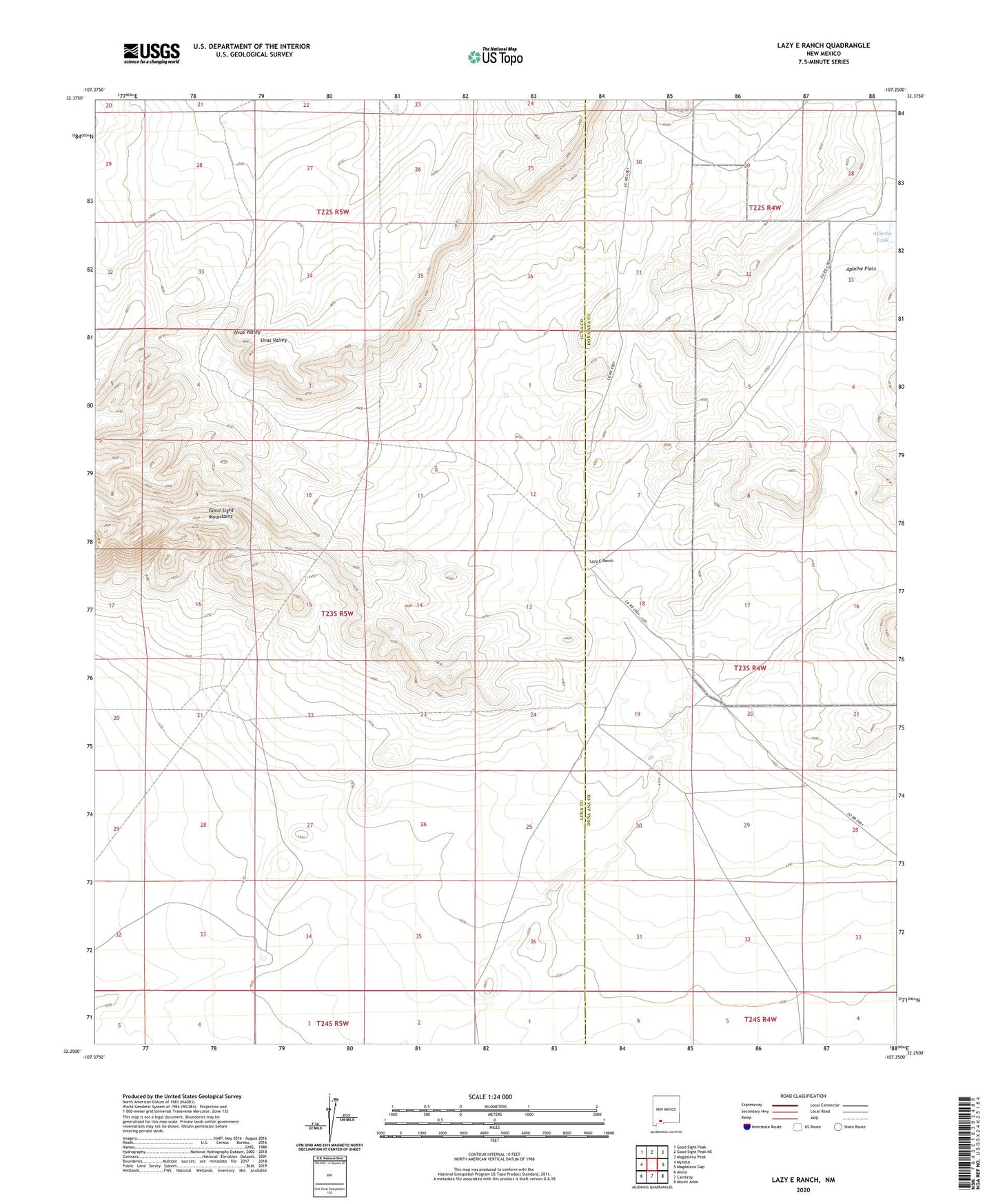
2020 topographic map quadrangle Lazy E Ranch in the state of New Mexico. Scale: 1:24000. Based on the newly updated USGS 7.5' US Topo map series, this map is in the following counties: Luna, Doña Ana. The map contains contour data, water features, and other items you are used to seeing on USGS maps, but also has updated roads and other features. This is the next generation of topographic maps. Printed on high-quality waterproof paper with UV fade-resistant inks.
Quads adjacent to this one:
West: Myndus
Northwest: Good Sight Peak
North: Good Sight Peak NE
Northeast: Magdalena Peak
East: Magdalena Gap
Southeast: Mount Aden
South: Cambray
Southwest: Akela
Contains the following named places: 01584 Water Well, 01587 Water Well, 01589 Water Well, 01590 Water Well, 01591 Water Well, 01680 Water Well, 06130 Water Well, 06131 Water Well, Apache Flats, Apache Tank, Burris 'E' Ranch Airport, Dog Town Windmill, Hood Wind Mill Water Well, Hood Windmill, Lazy E Ranch, Matamoros Windmill, Middle Windmill, Middle Windmill Water Well, Mountain Windmill, Number 1205 Water Well, Suman Windmill