MyTopo
Cambray New Mexico US Topo Map
Couldn't load pickup availability
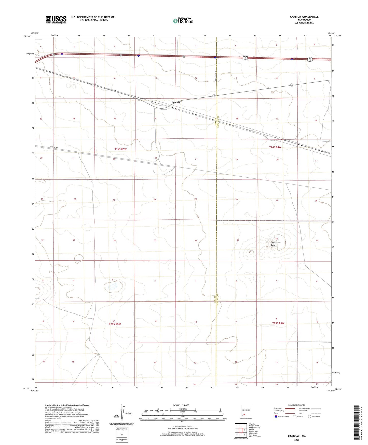
2023 topographic map quadrangle Cambray in the state of New Mexico. Scale: 1:24000. Based on the newly updated USGS 7.5' US Topo map series, this map is in the following counties: Luna, Doña Ana. The map contains contour data, water features, and other items you are used to seeing on USGS maps, but also has updated roads and other features. This is the next generation of topographic maps. Printed on high-quality waterproof paper with UV fade-resistant inks.
Quads adjacent to this one:
West: Akela
Northwest: Myndus
North: Lazy E Ranch
Northeast: Magdalena Gap
East: Mount Aden
Southeast: Mount Aden SW
South: X-7 Ranch
Southwest: Sibley Hole
This map covers the same area as the classic USGS quad with code o32107b3.
Contains the following named places: 01605 Water Well, 01612 Water Well, 01625 Water Well, 06055 Water Well, 1616 Water Well, Alkali Windmill, Cambray, Cambray Post Office, Cambray Weather Station, Cambray Windmill, Dona, Geronimo Ranch, Providence Cone, San Luis Windmill