MyTopo
Lobo Hill New Mexico US Topo Map
Couldn't load pickup availability
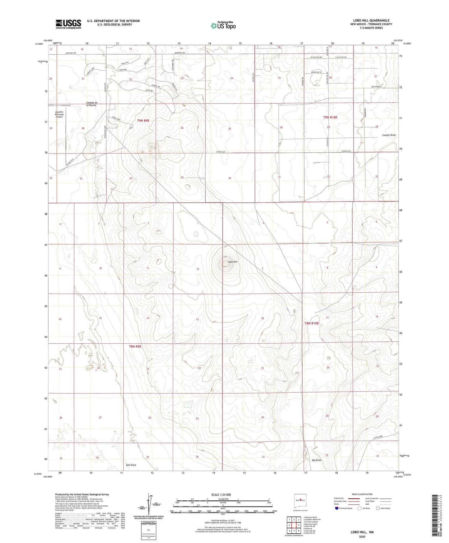
2020 topographic map quadrangle Lobo Hill in the state of New Mexico. Scale: 1:24000. Based on the newly updated USGS 7.5' US Topo map series, this map is in the following counties: Torrance. The map contains contour data, water features, and other items you are used to seeing on USGS maps, but also has updated roads and other features. This is the next generation of topographic maps. Printed on high-quality waterproof paper with UV fade-resistant inks.
Quads adjacent to this one:
West: Moriarty South
Northwest: Moriarty North
North: Longhorn Reservoir
Northeast: El Cuervo Butte
East: Lobo Hill NE
Southeast: Lobo Hill SE
South: Lobo Hill SW
Southwest: Estancia
Contains the following named places: 10213 Water Well, 10214 Water Well, 87035, Big Draw, Canada de la Puerta, Chavez Draw, Cottonwood Well, D Williams Ranch, Davis Ranch, Estancia Ranchettes, L Williams Ranch, Lamb Homestead, Lobo Hill, Middle Well, Ranch Huntley, West Well