MyTopo
Lobo Hill SW New Mexico US Topo Map
Couldn't load pickup availability
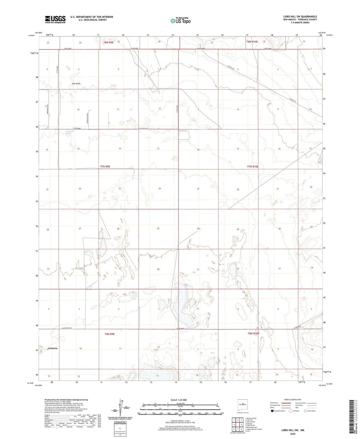
2023 topographic map quadrangle Lobo Hill SW in the state of New Mexico. Scale: 1:24000. Based on the newly updated USGS 7.5' US Topo map series, this map is in the following counties: Torrance. The map contains contour data, water features, and other items you are used to seeing on USGS maps, but also has updated roads and other features. This is the next generation of topographic maps. Printed on high-quality waterproof paper with UV fade-resistant inks.
Quads adjacent to this one:
West: Estancia
Northwest: Moriarty South
North: Lobo Hill
Northeast: Lobo Hill NE
East: Lobo Hill SE
Southeast: Lucy
South: Laguna Del Perro North
Southwest: Mountainair NE
This map covers the same area as the classic USGS quad with code o34105g8.
Contains the following named places: Berkshire Ranch, Buck Well, Childress Well, Cieneguita Spring, Estancia Division, Green Camp, Mattock Well, Middle Well, Old Price Ranch, Olympia Well, Piedroso Windmill, Price Ranch, Salt Draw, Sprule Windmill, ZIP Code: 87016