MyTopo
Moriarty North New Mexico US Topo Map
Couldn't load pickup availability
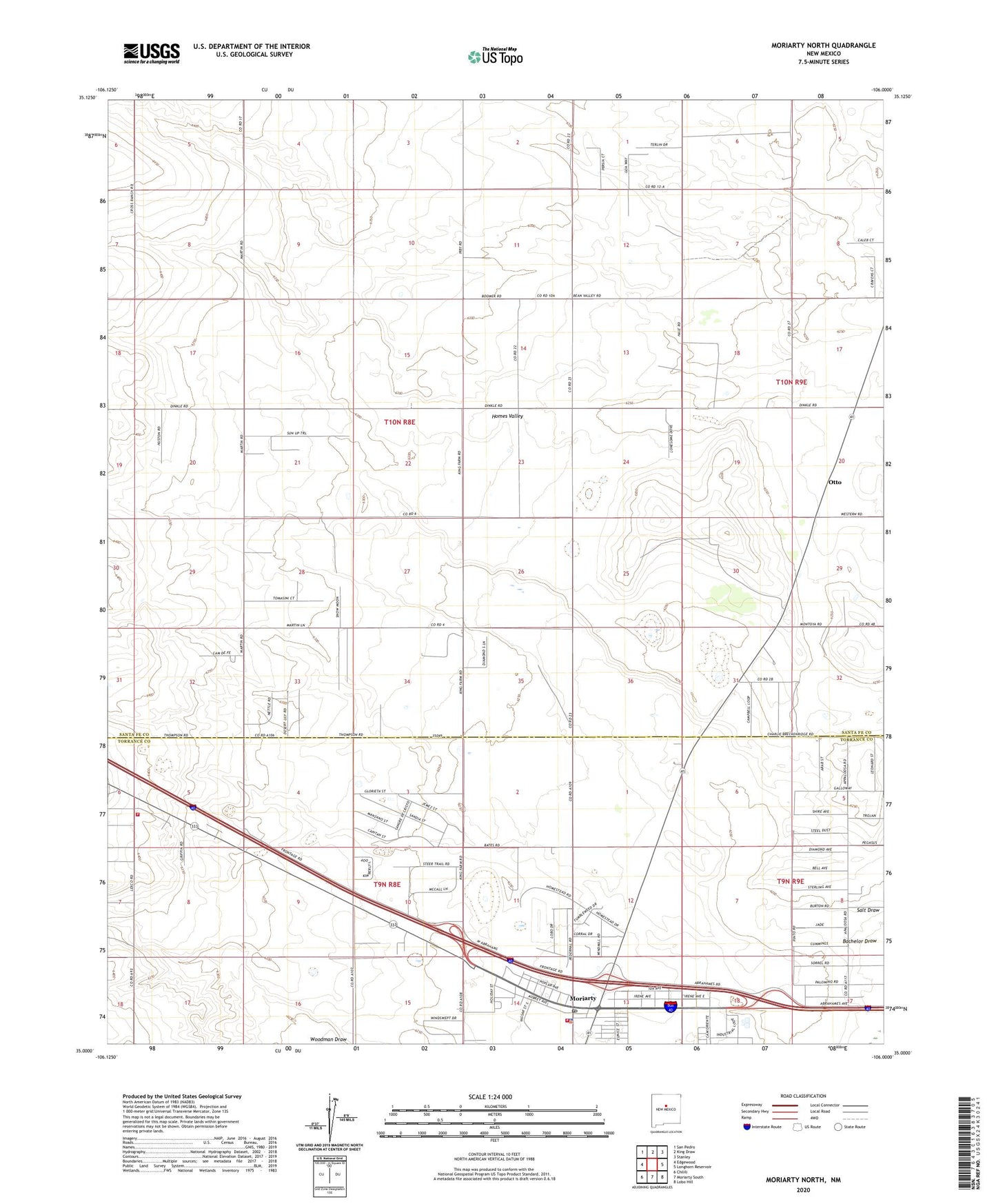
2023 topographic map quadrangle Moriarty North in the state of New Mexico. Scale: 1:24000. Based on the newly updated USGS 7.5' US Topo map series, this map is in the following counties: Santa Fe, Torrance. The map contains contour data, water features, and other items you are used to seeing on USGS maps, but also has updated roads and other features. This is the next generation of topographic maps. Printed on high-quality waterproof paper with UV fade-resistant inks.
Quads adjacent to this one:
West: Edgewood
Northwest: San Pedro
North: King Draw
Northeast: Stanley
East: Longhorn Reservoir
Southeast: Lobo Hill
South: Moriarty South
Southwest: Chilili
This map covers the same area as the classic USGS quad with code o35106a1.
Contains the following named places: 10004 Water Well, 10010 Water Well, 10065 Water Well, 10233 Water Well, 10247 Water Well, Bachelor Draw, Cavasos Place, City of Moriarty, Davis Ranch, Homes Valley, Johns Place, Martin Place, Moriarty Fire Department Main Station, Moriarty Police Department, Moriarty Post Office, Otto, Otto Post Office, Otto Weather Station, Water Well 10007, Water Well 10012, Water Well 10013, Water Well 10017