
MyTopo
Melrose West New Mexico US Topo Map
Couldn't load pickup availability
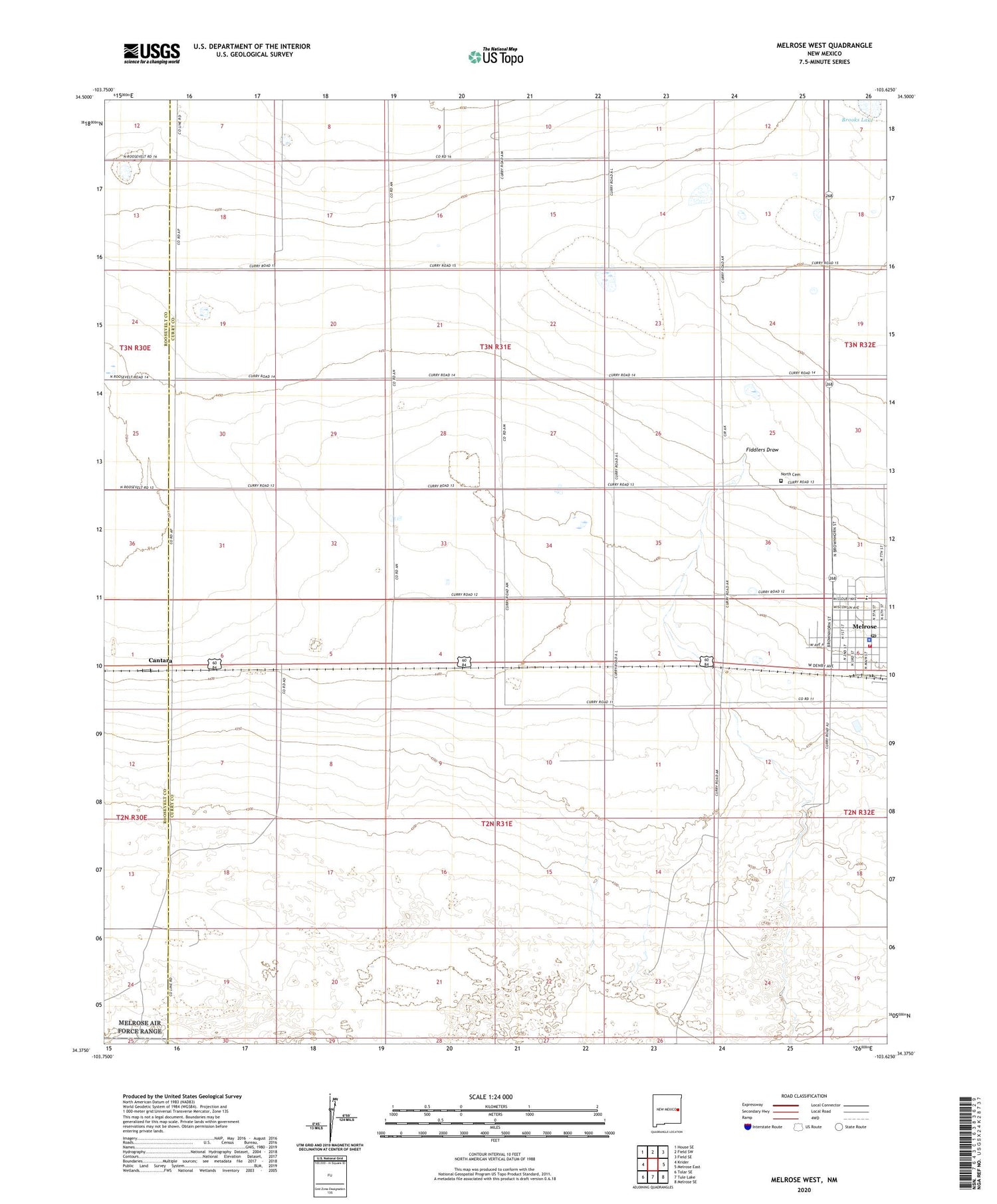
2020 topographic map quadrangle Melrose West in the state of New Mexico. Scale: 1:24000. Based on the newly updated USGS 7.5' US Topo map series, this map is in the following counties: Curry, Roosevelt. The map contains contour data, water features, and other items you are used to seeing on USGS maps, but also has updated roads and other features. This is the next generation of topographic maps. Printed on high-quality waterproof paper with UV fade-resistant inks.
Quads adjacent to this one:
West: Krider
Northwest: House SE
North: Field SW
Northeast: Field SE
East: Melrose East
Southeast: Melrose SE
South: Tule Lake
Southwest: Tolar SE
Contains the following named places: 05109 Water Well, 05113 Water Well, 10392 Water Well, 10468 Water Well, 10472 Water Well, 10473 Water Well, 10474 Water Well, 11636 Water Well, 11690 Water Well, Brooks Lake, Cantara, Cantara Post Office, Church of Christ, Church of the Prophecy, East Breedlove Well, Forrest Baptist Church, Melrose, Melrose Ambulance Service, Melrose City Marshal, Melrose Elementary School, Melrose First Baptist Church, Melrose High School, Melrose Police Department, Melrose Post Office, Melrose Volunteer Fire Department, Melrose Weather Station, North Cemetery, Smith Well, Village of Melrose, West Breedlove Well


