MyTopo
Montesito Creek New Mexico US Topo Map
Couldn't load pickup availability
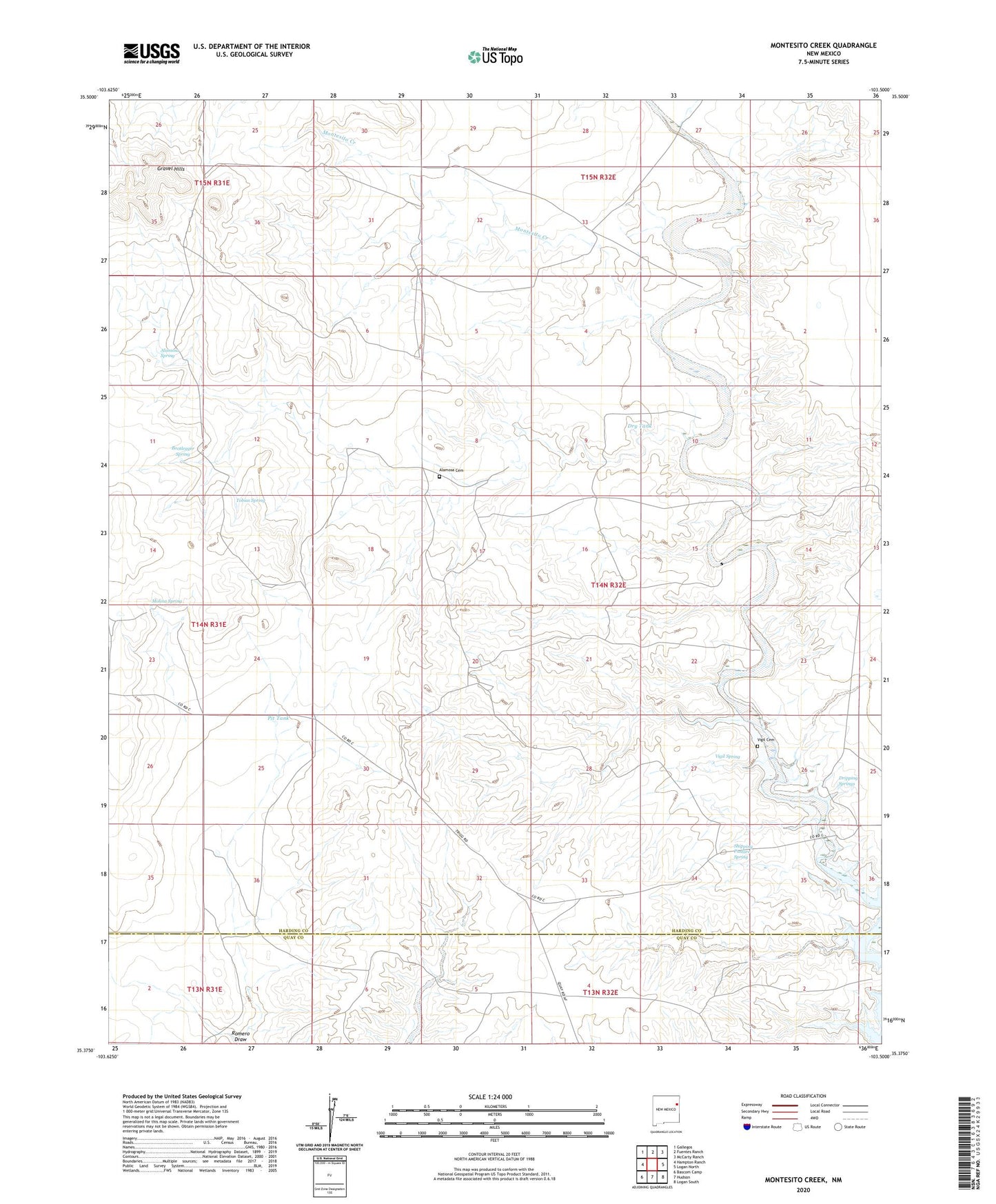
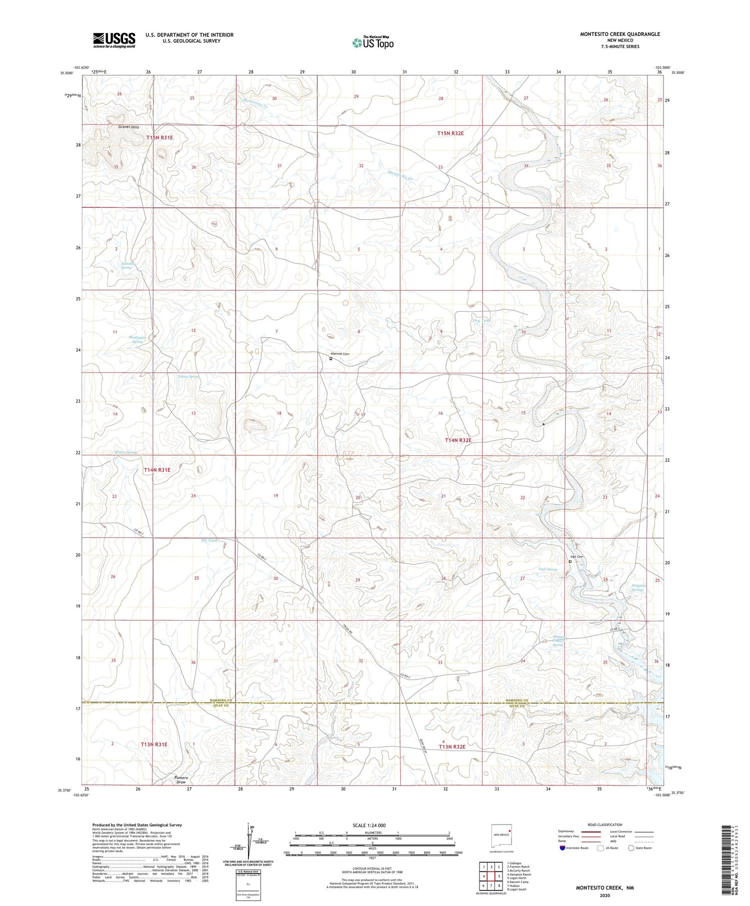
2020 topographic map quadrangle Montesito Creek in the state of New Mexico. Scale: 1:24000. Based on the newly updated USGS 7.5' US Topo map series, this map is in the following counties: Harding, Quay. The map contains contour data, water features, and other items you are used to seeing on USGS maps, but also has updated roads and other features. This is the next generation of topographic maps. Printed on high-quality waterproof paper with UV fade-resistant inks.
Quads adjacent to this one:
West: Hampton Ranch
Northwest: Gallegos
North: Fuentes Ranch
Northeast: McCarty Ranch
East: Logan North
Southeast: Logan South
South: Hudson
Southwest: Bascom Camp
Contains the following named places: 05501 Water Well, Alamosa Cemetery, Alamosa Creek, Alamosa Spring, Alamosa Windmill, Betties Windmill, Bootlegger Spring, Brace Windmill, Buckf Windmill, Chacon Camp, Cluck, Division Tank, Dripping Springs, Dry Tank, Duck Pond Tank, East Windmill, Fishpond Tank, Forks Windmill, Logan Ranch, Martinez Tank, Martinez Windmill, Middle Well, Molina Spring, Montesito Creek, Montesito School, Penitente Windmill, Pit Tank, Romero Flats Windmill, Salt Windmill, Sams Windmill, Shipping Pasture Spring, Tobias Spring, Tobias Windmill, Twin Tanks, Vigil Cemetery, Vigil Spring, White Windmill