MyTopo
Hampton Ranch New Mexico US Topo Map
Couldn't load pickup availability
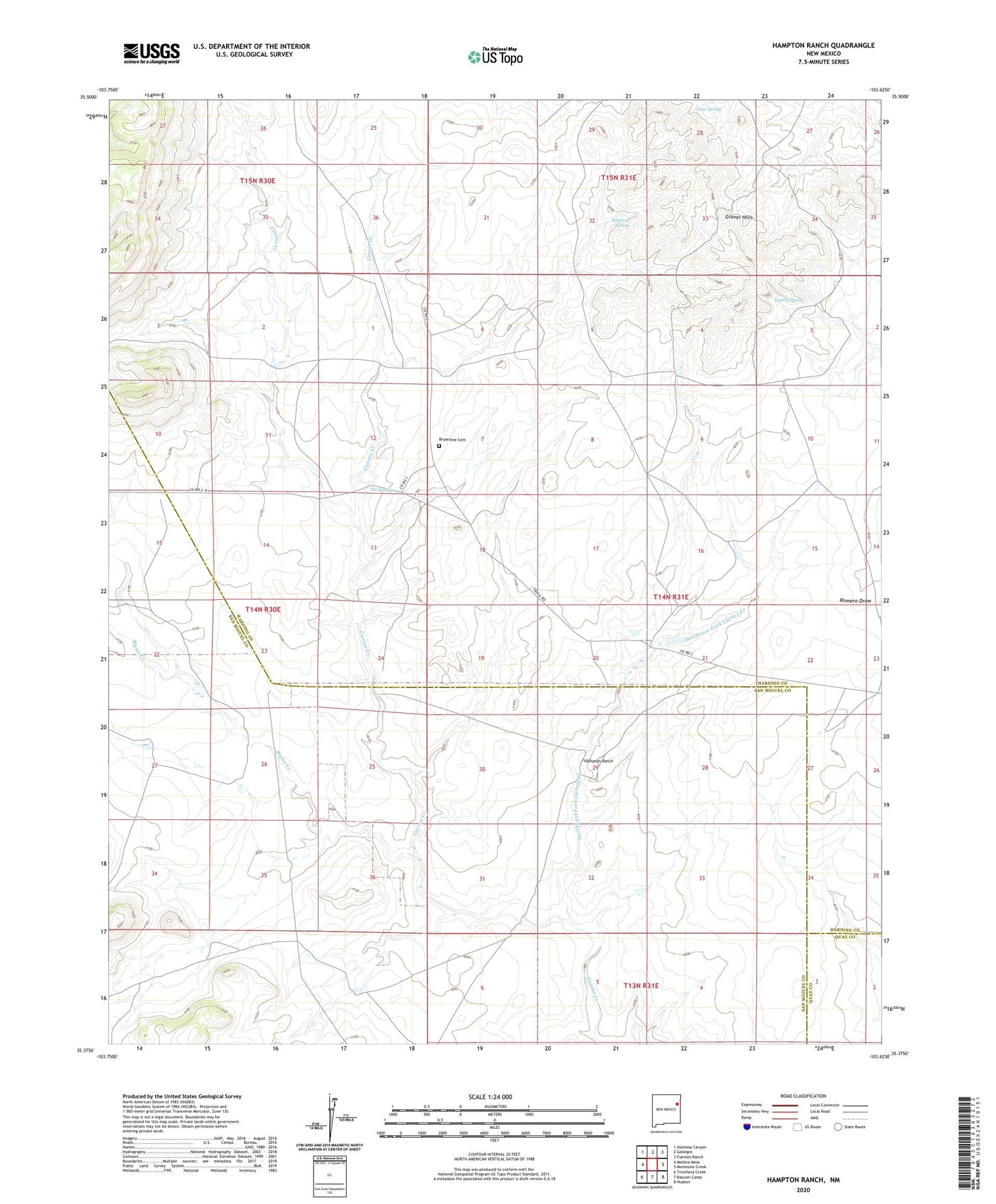
2023 topographic map quadrangle Hampton Ranch in the state of New Mexico. Scale: 1:24000. Based on the newly updated USGS 7.5' US Topo map series, this map is in the following counties: San Miguel, Harding, Quay. The map contains contour data, water features, and other items you are used to seeing on USGS maps, but also has updated roads and other features. This is the next generation of topographic maps. Printed on high-quality waterproof paper with UV fade-resistant inks.
Quads adjacent to this one:
West: Medina Mesa
Northwest: Alamosa Canyon
North: Gallegos
Northeast: Fuentes Ranch
East: Montesito Creek
Southeast: Hudson
South: Bascom Camp
Southwest: Trinchera Creek
This map covers the same area as the classic USGS quad with code o35103d6.
Contains the following named places: Bailey Windmill, Barker Windmill, Bryantine Cemetery, Cake House Well, Conejo Creek, Gap Well, Garcia Spring, Gravel Hills, Hampton Ranch, Holmes, House Pasture Windmill, John Pool Windmill, Luis Spring, McCuistion Camp, Northeast Fork Carros Creek, Oscar Pool Windmill, Pyle Windmill, Ramirez Spring, Ramirez Windmill, Sinkhole Trap Windmill, Southeast Windmill, The Spring, Weeks Windmill, Wynn Creek