MyTopo
Montezuma New Mexico US Topo Map
Couldn't load pickup availability
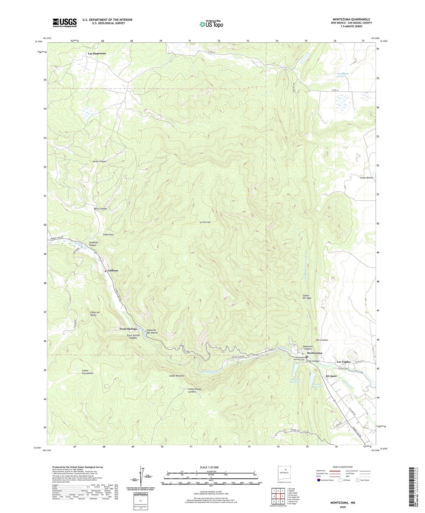
2020 topographic map quadrangle Montezuma in the state of New Mexico. Scale: 1:24000. Based on the newly updated USGS 7.5' US Topo map series, this map is in the following counties: San Miguel. The map contains contour data, water features, and other items you are used to seeing on USGS maps, but also has updated roads and other features. This is the next generation of topographic maps. Printed on high-quality waterproof paper with UV fade-resistant inks.
Quads adjacent to this one:
West: El Porvenir
Northwest: Rociada
North: Sapello
Northeast: Lake Isabel
East: Las Vegas NW
Southeast: Las Vegas
South: Ojitos Frios
Southwest: San Geronimo
Contains the following named places: Amand Hammer World College of the American West, Aranda, Armand Hammer United World College of the American West Library, Berts Canyon, Bradner Dam, Bradner Reservoir, Canada de Cerro Colorado, Canon Alto, Canon de Medio, Canon de Ojo Sabina, Canon del Agua, El Llano, Gallinas, Gallinas School, Hot Springs, Hot Springs Post Office, Jarita Canyon, La Sierrita, Las Dispensas, Las Vegas Irrigation Project Diversion Dam Historic Site, Lime Canyon, Los Vigiles, Los Vigiles Post Office, Mathieson, Montezuma, Montezuma Hotel Complex Historic Site, Montezuma Post Office, Montezuma Seminary Cemetery, Pelt, Peterson Dam, Peterson Reservoir, Rancho Bonito, Rio De Vega Ranch, Sagrado Corazon Church, San Miguel County Fire District La Placita Fire Department, Sandoval Canyon, Sanguijuela Arroyo, Sebastian Canyon, Storrie Dam, Storrie Intake Canal, Trout Springs, Trout Springs Canyon, W Bar K Ranch