MyTopo
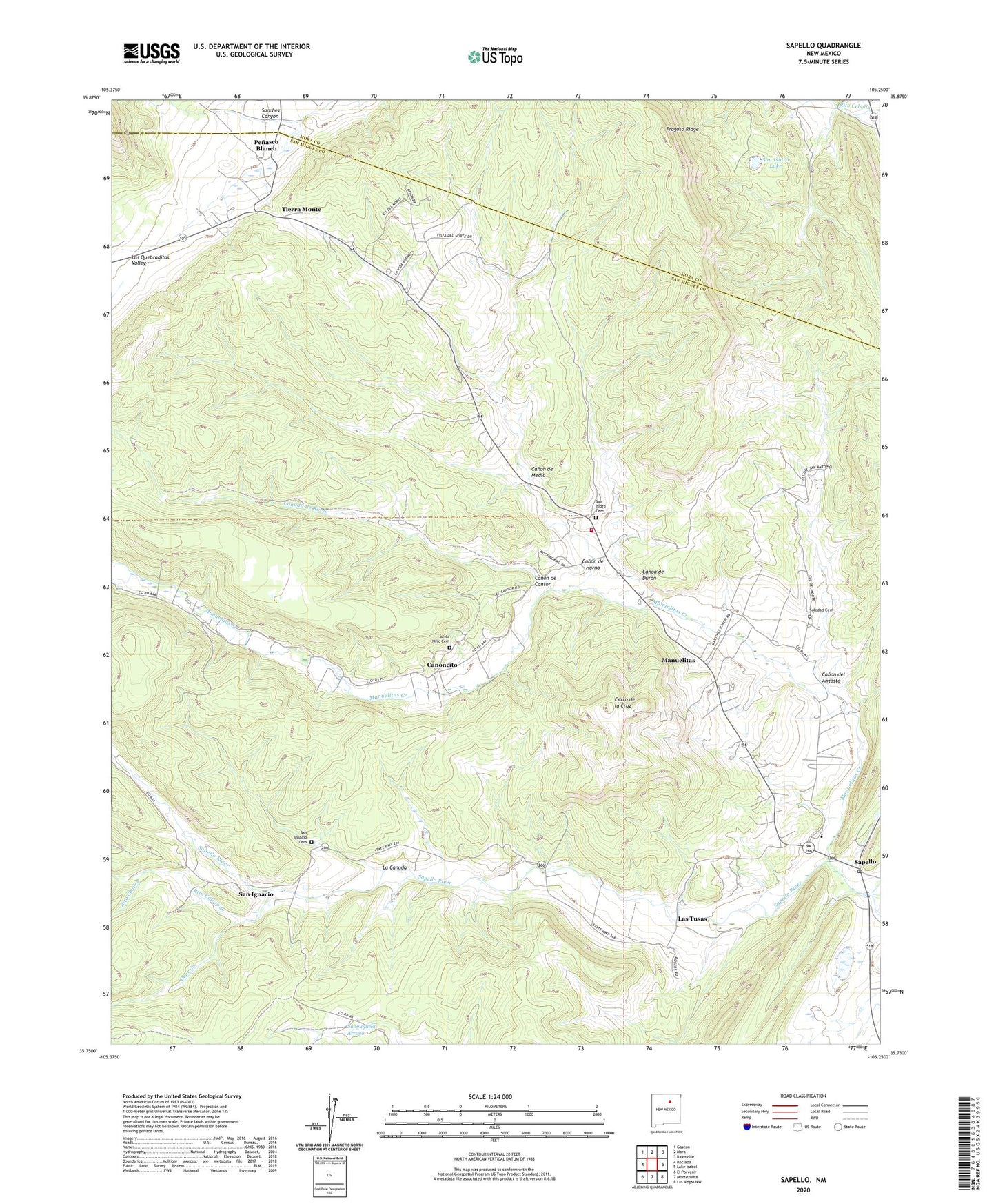
Sapello New Mexico US Topo Map
Couldn't load pickup availability
Also explore the Sapello Forest Service Topo of this same quad for updated USFS data
2023 topographic map quadrangle Sapello in the state of New Mexico. Scale: 1:24000. Based on the newly updated USGS 7.5' US Topo map series, this map is in the following counties: San Miguel, Mora. The map contains contour data, water features, and other items you are used to seeing on USGS maps, but also has updated roads and other features. This is the next generation of topographic maps. Printed on high-quality waterproof paper with UV fade-resistant inks.
Quads adjacent to this one:
West: Rociada
Northwest: Gascon
North: Mora
Northeast: Rainsville
East: Lake Isabel
Southeast: Las Vegas NW
South: Montezuma
Southwest: El Porvenir
This map covers the same area as the classic USGS quad with code o35105g3.
Contains the following named places: Brother of Jesus Mission, Canada de Rocio, Canon de Cantor, Canon de Duran, Canon de Horno, Canon de Medio, Canon del Angosto, Canoncito, Cerro de la Cruz, Deer Creek, Don Tomas, El Valle, Fragoso Ridge, La Canada, Las Dispensas, Las Tusas, Manuelitas, Manuelitas Creek, Pena, Penasco Blanco, Rito Chavez, Rito Colorado, San Ignacio, San Ignacio Cemetery, San Ignacio Post Office, San Isidro Cemetery, San Isidro Lake, San Miguel County Fire District Sapello Rociada Fire Department, Santa Nino Cemetery, Sapello, Sapello Elementary School, Sapello Post Office, Soledad Cemetery, Tierra Monte, Woods