MyTopo
Ojitos Frios New Mexico US Topo Map
Couldn't load pickup availability
Also explore the Ojitos Frios Forest Service Topo of this same quad for updated USFS data
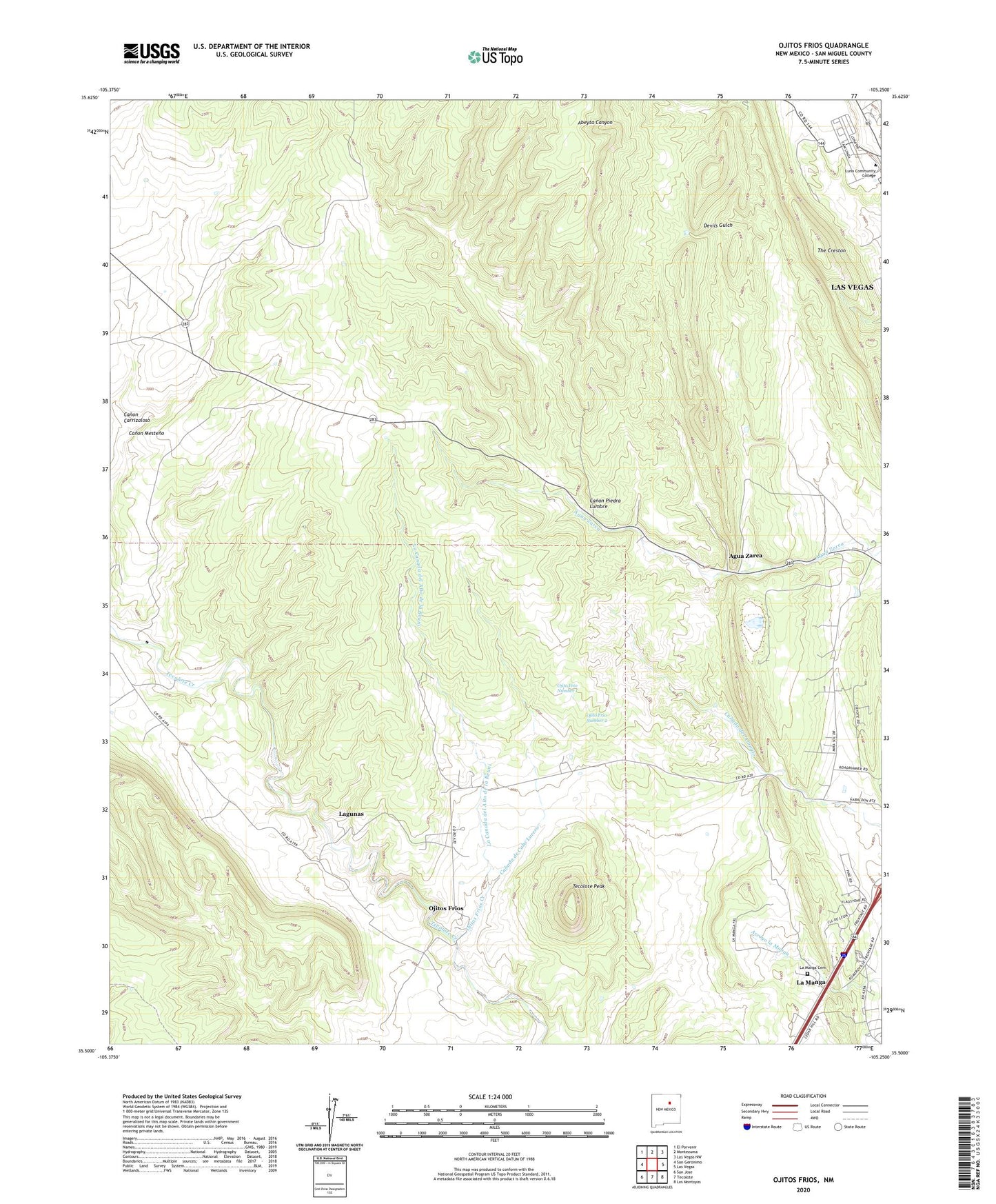
2023 topographic map quadrangle Ojitos Frios in the state of New Mexico. Scale: 1:24000. Based on the newly updated USGS 7.5' US Topo map series, this map is in the following counties: San Miguel. The map contains contour data, water features, and other items you are used to seeing on USGS maps, but also has updated roads and other features. This is the next generation of topographic maps. Printed on high-quality waterproof paper with UV fade-resistant inks.
Quads adjacent to this one:
West: San Geronimo
Northwest: El Porvenir
North: Montezuma
Northeast: Las Vegas NW
East: Las Vegas
Southeast: Los Montoyas
South: Tecolote
Southwest: San Jose
This map covers the same area as the classic USGS quad with code o35105e3.
Contains the following named places: Agua Zarca, Box Ranch, Camp Maximiliano Luna, Camp Maximiliano Luna Historical Marker, Canada de Cabo Lucero, Canon Carrizaloso, Canon Mesteno, Canon Piedra Lumbre, Devils Gulch, Forest Ranch, King Stadium, La Canada del Alto de la Reuni, La Manga, La Manga Cemetery, Lagunas, Las Vegas Town, Ojito Frio Number 1, Ojito Frio Number 2, Ojitos Frios, Ojitos Frios Creek, Ojitos Frios Ranch, Santo Nino Church, Tecolote Peak, The Creston