MyTopo
Mount Washington New Mexico US Topo Map
Couldn't load pickup availability
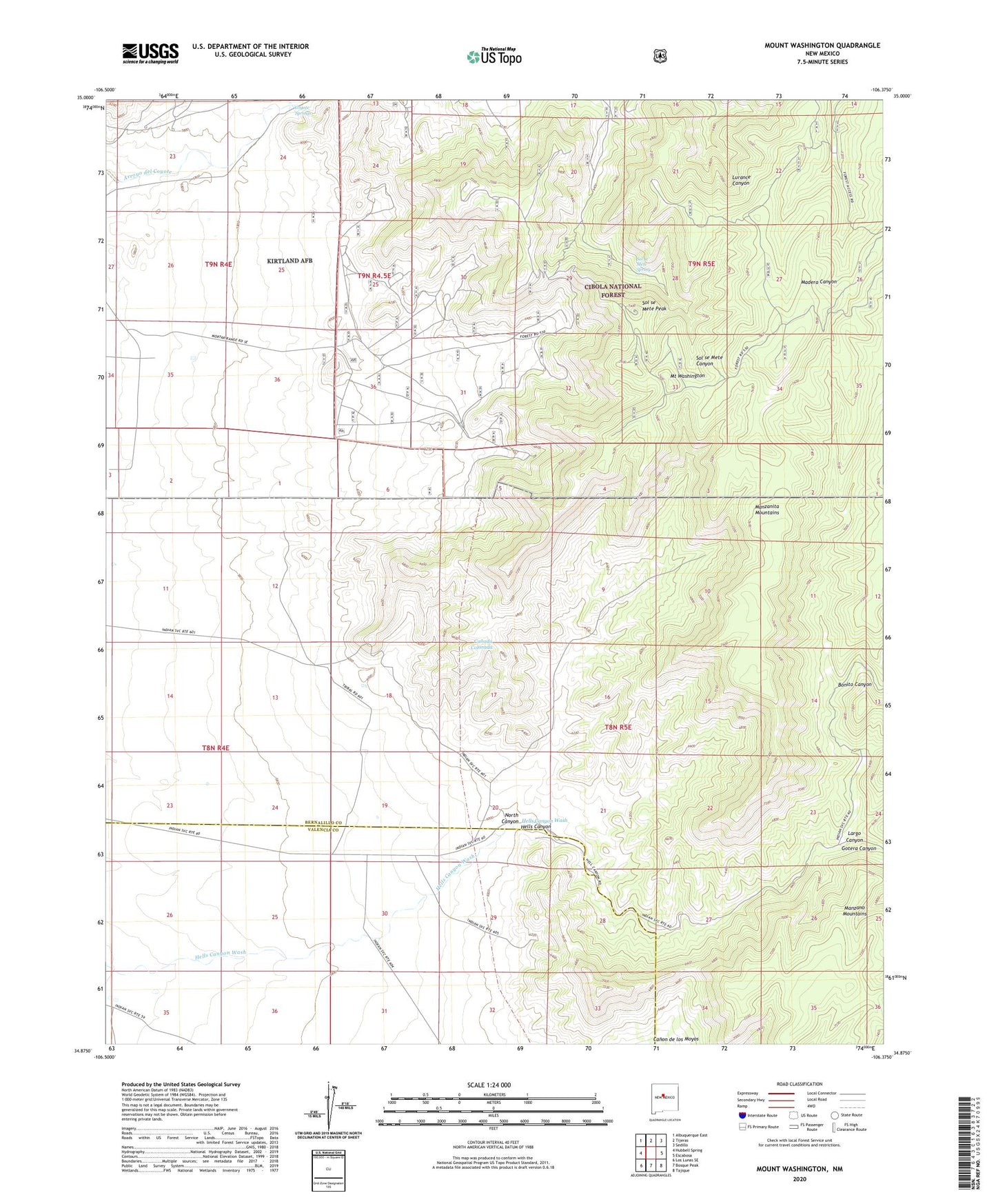
2020 topographic map quadrangle Mount Washington in the state of New Mexico. Scale: 1:24000. Based on the newly updated USGS 7.5' US Topo map series, this map is in the following counties: Bernalillo, Valencia. The map contains contour data, water features, and other items you are used to seeing on USGS maps, but also has updated roads and other features. This is the next generation of topographic maps. Printed on high-quality waterproof paper with UV fade-resistant inks.
Quads adjacent to this one:
West: Hubbell Spring
Northwest: Albuquerque East
North: Tijeras
Northeast: Sedillo
East: Escabosa
Southeast: Tajique
South: Bosque Peak
Southwest: Los Lunas SE
Contains the following named places: Belvidere Group, Bonito Canyon, Coyote Springs, Eighty-Five Prospect, Galena King, Gotera Canyon, Hardinand Claim, Hells Canyon, Isleta Quartz Mine, Isleta Tract, Isleta Well, Kirtland Air Force Base, Largo Canyon, Manzano Lookout Tower, Milagros Mine, Moore Prospect, Mount Washington, North Canyon, Quail Lode, River View Placer, Sol se Mete Peak, Sol se Mete Spring, USC and GS Laboratory Seismological Laboratory