MyTopo
Los Lunas SE New Mexico US Topo Map
Couldn't load pickup availability
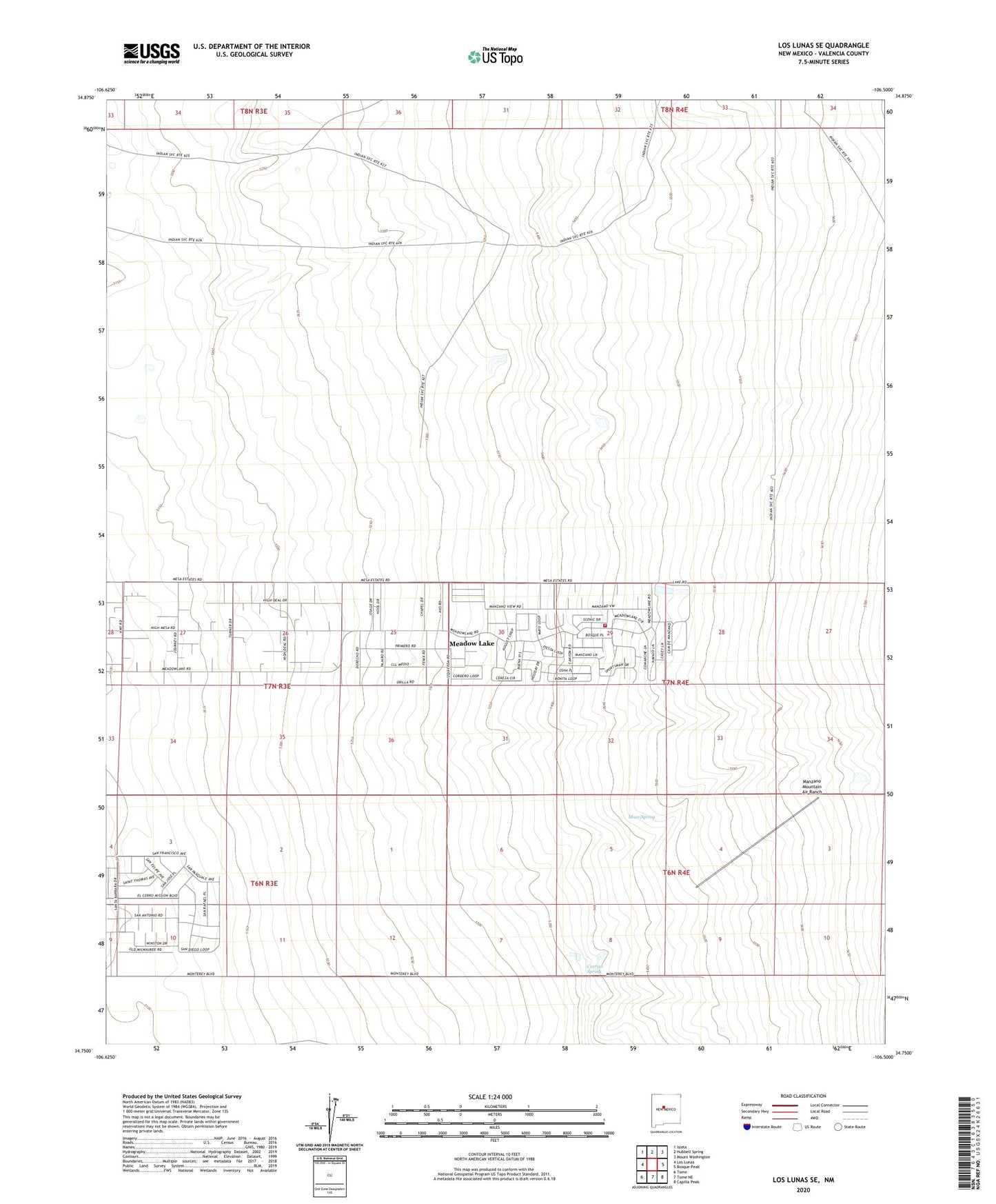
2023 topographic map quadrangle Los Lunas SE in the state of New Mexico. Scale: 1:24000. Based on the newly updated USGS 7.5' US Topo map series, this map is in the following counties: Valencia. The map contains contour data, water features, and other items you are used to seeing on USGS maps, but also has updated roads and other features. This is the next generation of topographic maps. Printed on high-quality waterproof paper with UV fade-resistant inks.
Quads adjacent to this one:
West: Los Lunas
Northwest: Isleta
North: Hubbell Spring
Northeast: Mount Washington
East: Bosque Peak
Southeast: Capilla Peak
South: Tome NE
Southwest: Tome
This map covers the same area as the classic USGS quad with code o34106g5.
Contains the following named places: 10030 Water Well, 87068, Carrizo Spring, Juan Otero Grant, Lo De Padilla Grant, Los Lunas Community Library, Maes Spring, Manzano Mountain Air Ranch, Meadow Lake, Meadow Lake Census Designated Place, Meadowlake Volunteer Fire Department, RG 16057-5-3 Water Well