MyTopo
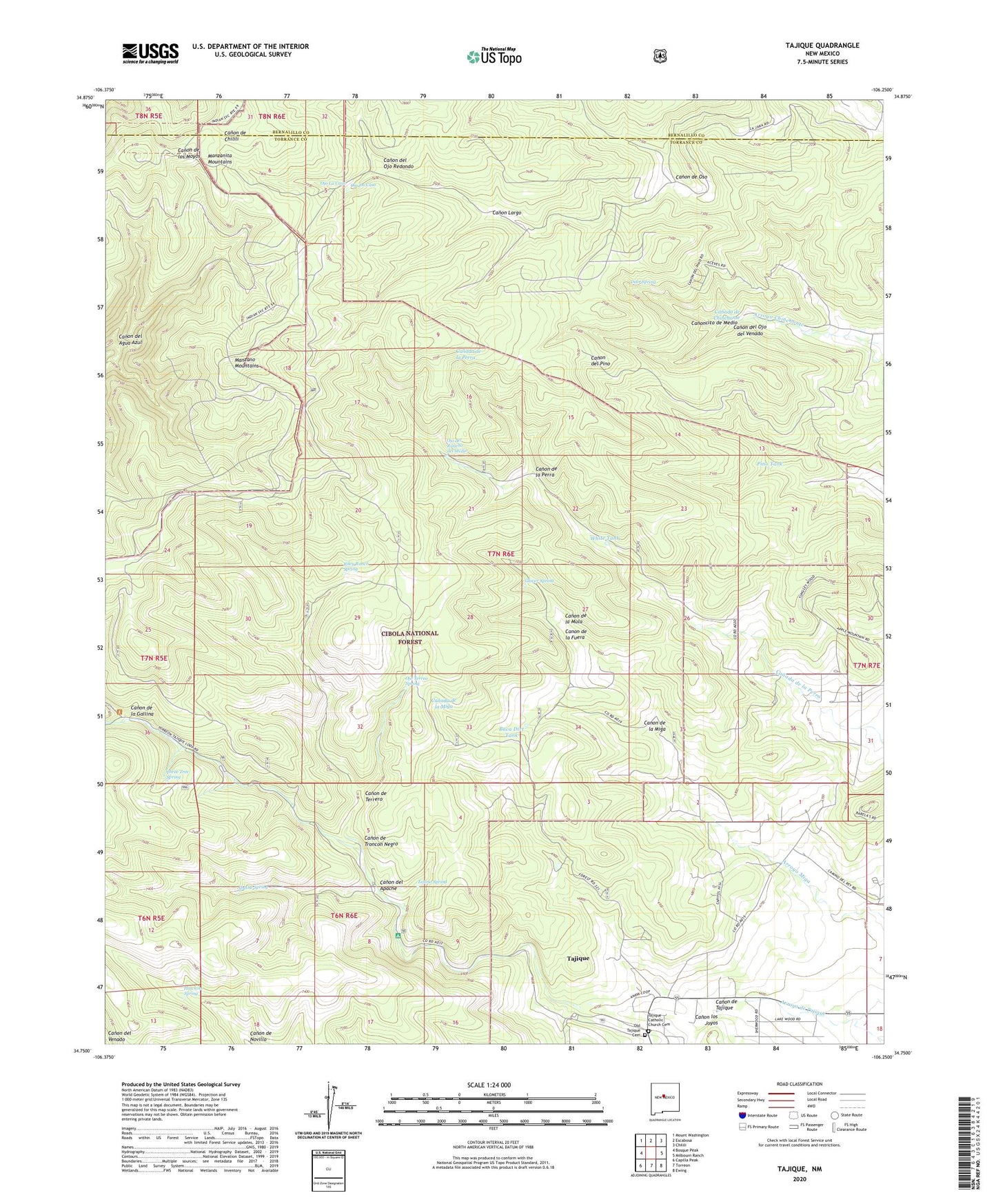
Tajique New Mexico US Topo Map
Couldn't load pickup availability
Also explore the Tajique Forest Service Topo of this same quad for updated USFS data
2023 topographic map quadrangle Tajique in the state of New Mexico. Scale: 1:24000. Based on the newly updated USGS 7.5' US Topo map series, this map is in the following counties: Torrance, Bernalillo. The map contains contour data, water features, and other items you are used to seeing on USGS maps, but also has updated roads and other features. This is the next generation of topographic maps. Printed on high-quality waterproof paper with UV fade-resistant inks.
Quads adjacent to this one:
West: Bosque Peak
Northwest: Mount Washington
North: Escabosa
Northeast: Chilili
East: Milbourn Ranch
Southeast: Ewing
South: Torreon
Southwest: Capilla Peak
This map covers the same area as the classic USGS quad with code o34106g3.
Contains the following named places: Albuquerque Trailhead, Apache Spring, Baca Dirt Tank, Barales School, Canon de la Fuera, Canon de la Gallina, Canon de la Miga, Canon de la Mula, Canon de la Perra, Canon de Oso, Canon de Tajique, Canon de Terrero, Canon de Troncon Negro, Canon del Agua Azul, Canon del Apache, Canon del Ojo del Venado, Canon del Ojo Redondo, Canon Largo, Canon los Joyos, Canoncito de Medio, Deer Spring, E-3658 Water Well, El Chinchonte Ranch, Glover Place, Glover Spring, Hawkins Spring, Inlow Youth Camp, King Place, La Jaral Ranch, Nelson Place, North End Trick Tank, Ojo del Rancho del Medio, Ojo La Casa, Ojo los Caso, Ojo Terreo Spring, Old Tajique Cemetery, Pino Tank, Riley Place, Riley Ranch Spring, Sun Valley Ranch, Tajique, Tajique Cabin, Tajique Campground, Tajique Catholic Church Cemetery, Tajique Census Designated Place, Tajique Post Office, Tajique Weather Station, Tejano Spring, Three Tree Spring, Town of Tajique Grant, White Tank