MyTopo
Mountainair New Mexico US Topo Map
Couldn't load pickup availability
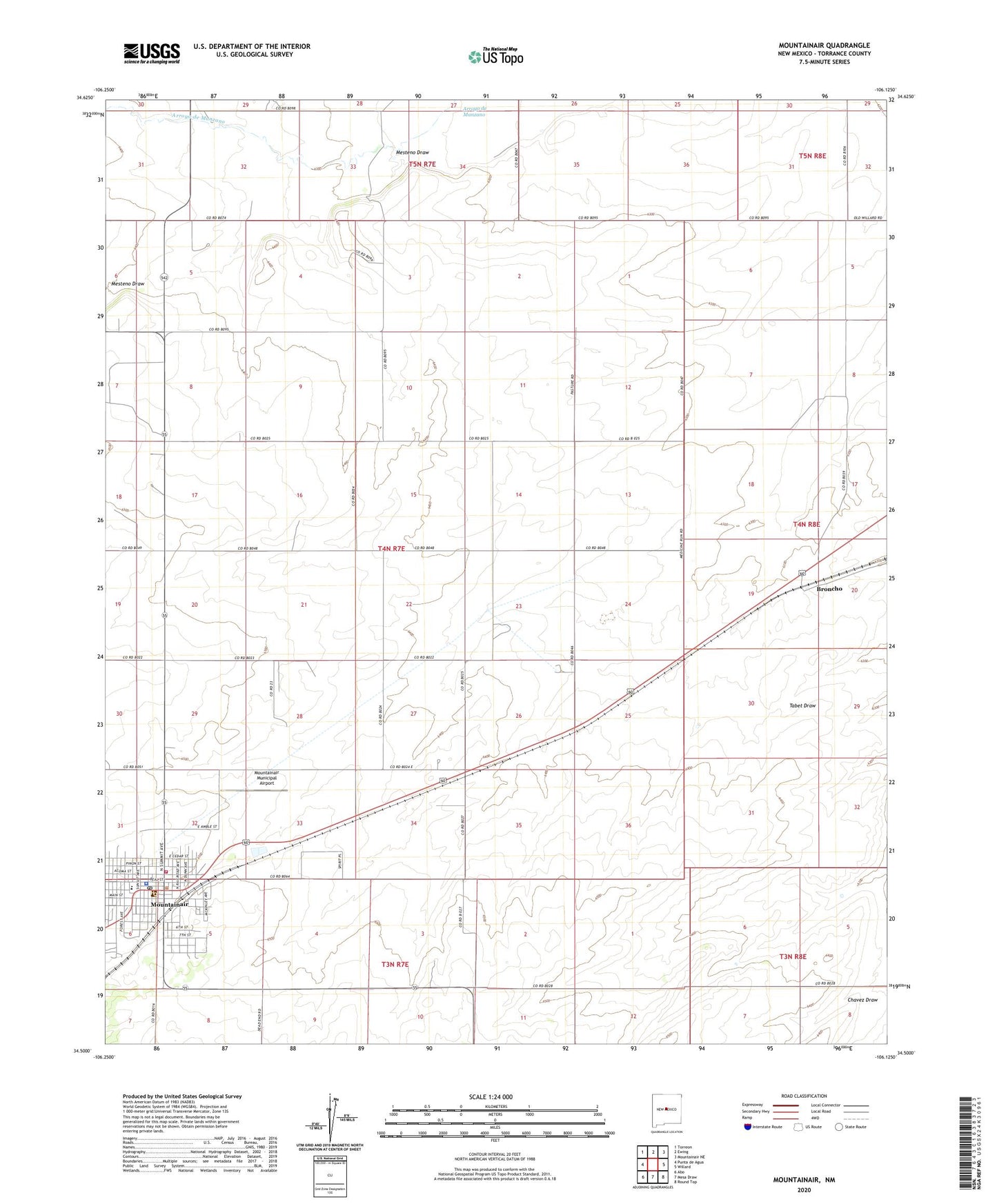
2020 topographic map quadrangle Mountainair in the state of New Mexico. Scale: 1:24000. Based on the newly updated USGS 7.5' US Topo map series, this map is in the following counties: Torrance. The map contains contour data, water features, and other items you are used to seeing on USGS maps, but also has updated roads and other features. This is the next generation of topographic maps. Printed on high-quality waterproof paper with UV fade-resistant inks.
Quads adjacent to this one:
West: Punta de Agua
Northwest: Torreon
North: Ewing
Northeast: Mountainair NE
East: Willard
Southeast: Round Top
South: Mesa Draw
Southwest: Abo
Contains the following named places: 10239 Water Well, Assembly of God Church, AT and SF RR Depot in Mountainair, Broncho, Bullington Ranch, Church of the Nazarene, First Baptist Church, Hinman Ranch, Jacks Pit, Mesteno Draw, Moiuntainair Christian Center, Mountainair, Mountainair Civic Library, Mountainair Elementary School, Mountainair Historical Marker, Mountainair Municipal Airport, Mountainair Municipal Auditorium, Mountainair Pit, Mountainair Police Department, Mountainair Post Office, Mountainair Rodeo Ground, Mountainair Volunteer Fire Department, Mountainair Weather Station, New Beginnings Christian School, Number 2 Water Well, Saint Alice Church, Salinas National Monument Headquarters and Visitor Center, Salinas Pueblo Missions National Monument Visitor Center, Spangler Windmill, Test 4 Water Well, Town of Mountainair