MyTopo
Naschitti New Mexico US Topo Map
Couldn't load pickup availability
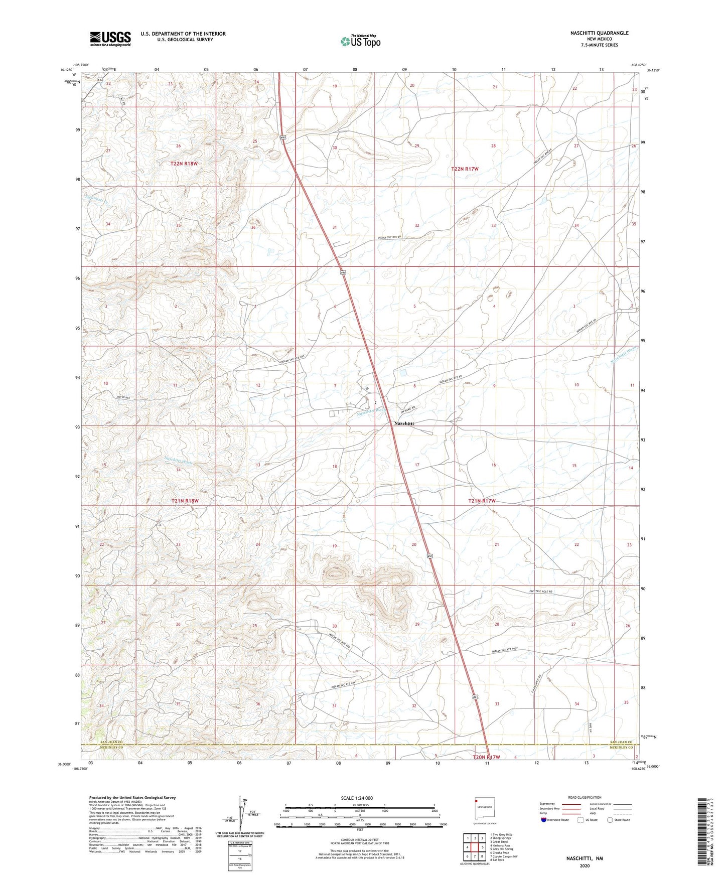
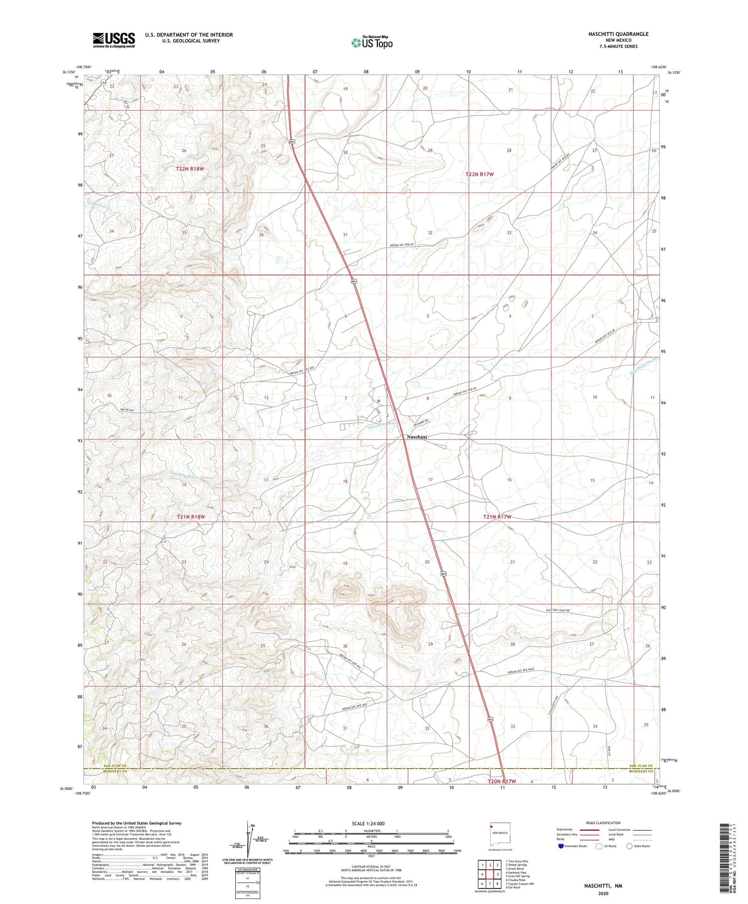
2020 topographic map quadrangle Naschitti in the state of New Mexico. Scale: 1:24000. Based on the newly updated USGS 7.5' US Topo map series, this map is in the following counties: San Juan, McKinley. The map contains contour data, water features, and other items you are used to seeing on USGS maps, but also has updated roads and other features. This is the next generation of topographic maps. Printed on high-quality waterproof paper with UV fade-resistant inks.
Quads adjacent to this one:
West: Narbona Pass
Northwest: Two Grey Hills
North: Sheep Springs
Northeast: Great Bend
East: Grey Hill Spring
Southeast: Ear Rock
South: Coyote Canyon NW
Southwest: Chuska Peak
Contains the following named places: 14-5-6 Water Well, 14N-85 Water Well, 14T-520 Water Well, 14T-521 Water Well, 14T-535 Water Well, Naschitti, Naschitti Cemetery, Naschitti Census Designated Place, Naschitti Division, Southern Naschitti Dam