MyTopo
Coyote Canyon NW New Mexico US Topo Map
Couldn't load pickup availability
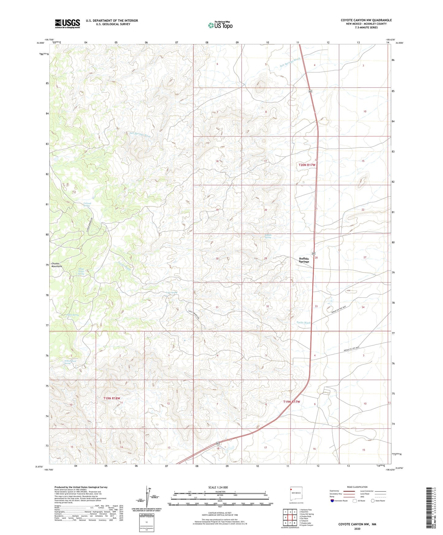
2023 topographic map quadrangle Coyote Canyon NW in the state of New Mexico. Scale: 1:24000. Based on the newly updated USGS 7.5' US Topo map series, this map is in the following counties: McKinley. The map contains contour data, water features, and other items you are used to seeing on USGS maps, but also has updated roads and other features. This is the next generation of topographic maps. Printed on high-quality waterproof paper with UV fade-resistant inks.
Quads adjacent to this one:
West: Chuska Peak
Northwest: Narbona Pass
North: Naschitti
Northeast: Grey Hill Spring
East: Ear Rock
Southeast: Coyote Canyon
South: Chuska Lake
Southwest: Tohatchi
This map covers the same area as the classic USGS quad with code o35108h6.
Contains the following named places: Buffalo Spring, Buffalo Springs, Covered Spring, Gallup 3 Water Well, Gallup 5 Water Well, Gallup H Water Well, Gallup Pumping Station, Loca Spring, Pinon Spring, Tohatchi Chapter, Trotz Construction Pit, White Water Spring, Willow Reed Spring