MyTopo
Narbona Pass New Mexico US Topo Map
Couldn't load pickup availability
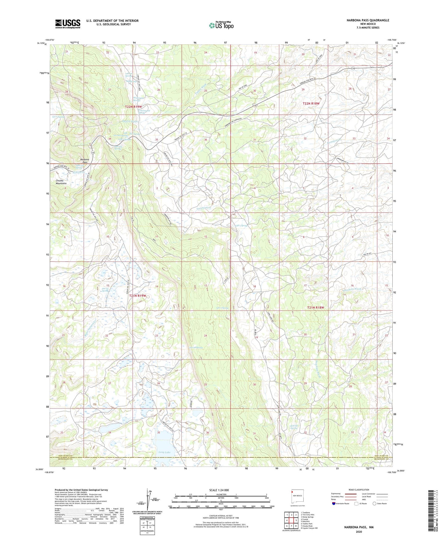
2023 topographic map quadrangle Narbona Pass in the state of New Mexico. Scale: 1:24000. Based on the newly updated USGS 7.5' US Topo map series, this map is in the following counties: San Juan, McKinley. The map contains contour data, water features, and other items you are used to seeing on USGS maps, but also has updated roads and other features. This is the next generation of topographic maps. Printed on high-quality waterproof paper with UV fade-resistant inks.
Quads adjacent to this one:
West: Crystal
Northwest: Toadlena
North: Two Grey Hills
Northeast: Sheep Springs
East: Naschitti
Southeast: Coyote Canyon NW
South: Chuska Peak
Southwest: Todilto Park
This map covers the same area as the classic USGS quad with code o36108a7.
Contains the following named places: 12A-6 Spring, 12M-1 Spring, 12R-160 Spring, 12R-161 Owl Spring, 12R-162 Spring, 12T-121 Water Well, 14GS-68-1 Spring, 14M-108 Spring, 14N-1 Spring, 14N-2 Spring, 300-95 Spring, 300-98 Spring, Cottonwood Spring, Long Lake, Missionary Springs, Narbona Pass, Oak Spring, Owl Spring, Tseanazti Creek, Washington Pass Radar Site