MyTopo
Norton New Mexico US Topo Map
Couldn't load pickup availability
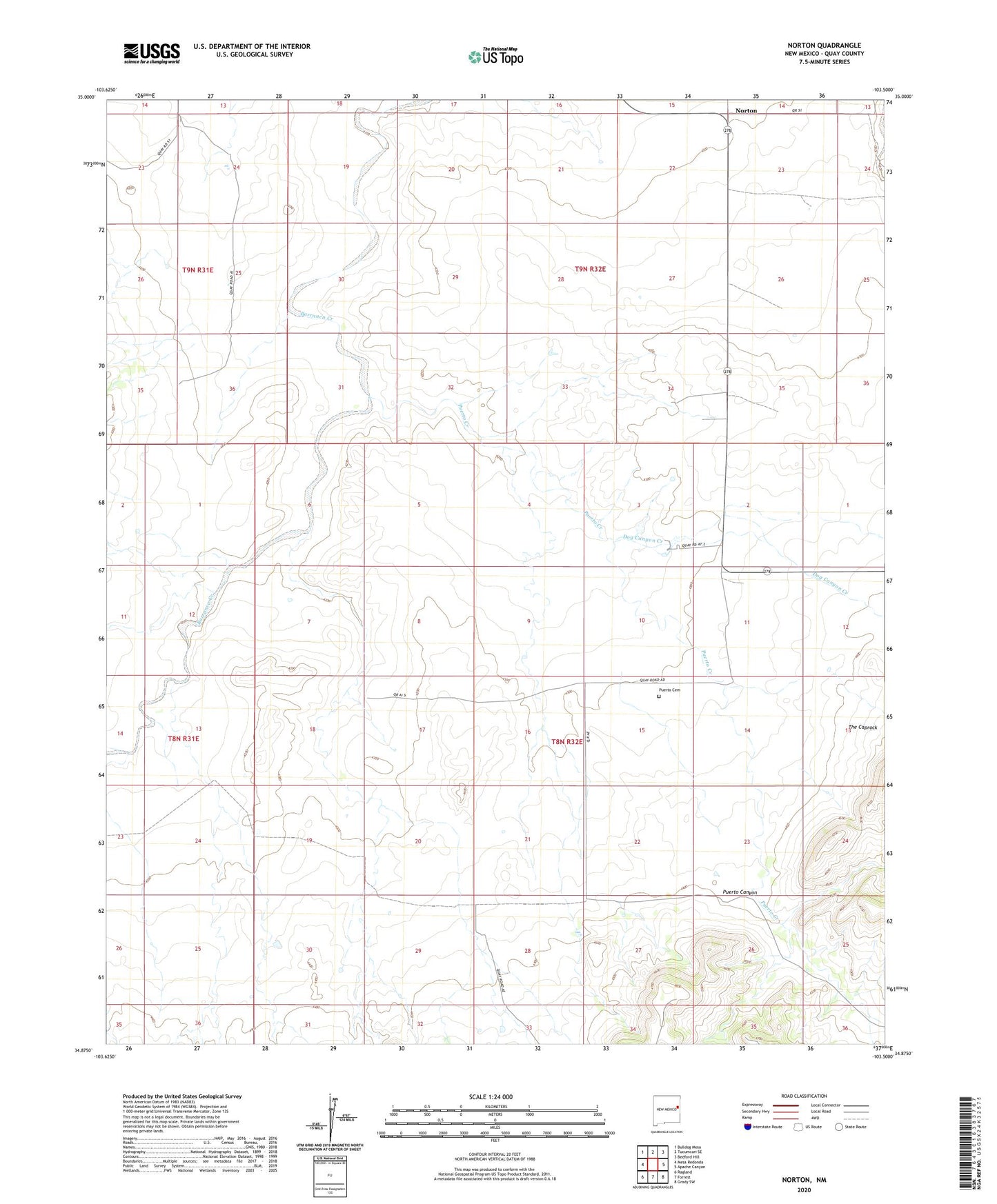
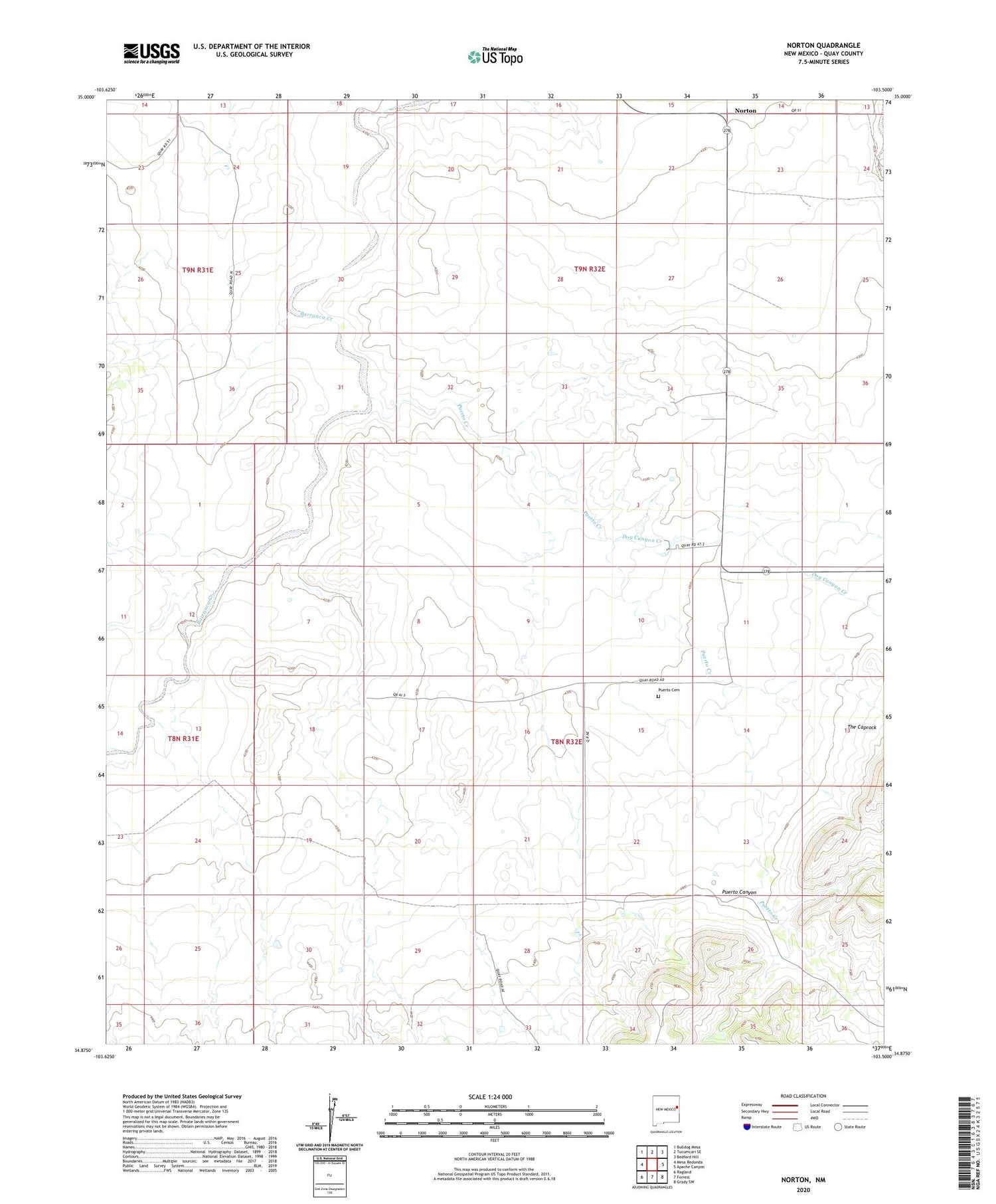
2020 topographic map quadrangle Norton in the state of New Mexico. Scale: 1:24000. Based on the newly updated USGS 7.5' US Topo map series, this map is in the following counties: Quay. The map contains contour data, water features, and other items you are used to seeing on USGS maps, but also has updated roads and other features. This is the next generation of topographic maps. Printed on high-quality waterproof paper with UV fade-resistant inks.
Quads adjacent to this one:
West: Mesa Redonda
Northwest: Bulldog Mesa
North: Tucumcari SE
Northeast: Bedford Hill
East: Apache Canyon
Southeast: Grady SW
South: Forrest
Southwest: Ragland
Contains the following named places: 10266 Water Well, Dog Canyon Creek, Hodges, Norton, Norton Post Office, Puerto, Puerto Canyon, Puerto Cemetery, Puerto Creek, Puerto Post Office, The Caprock, Woodard