MyTopo
Ragland New Mexico US Topo Map
Couldn't load pickup availability
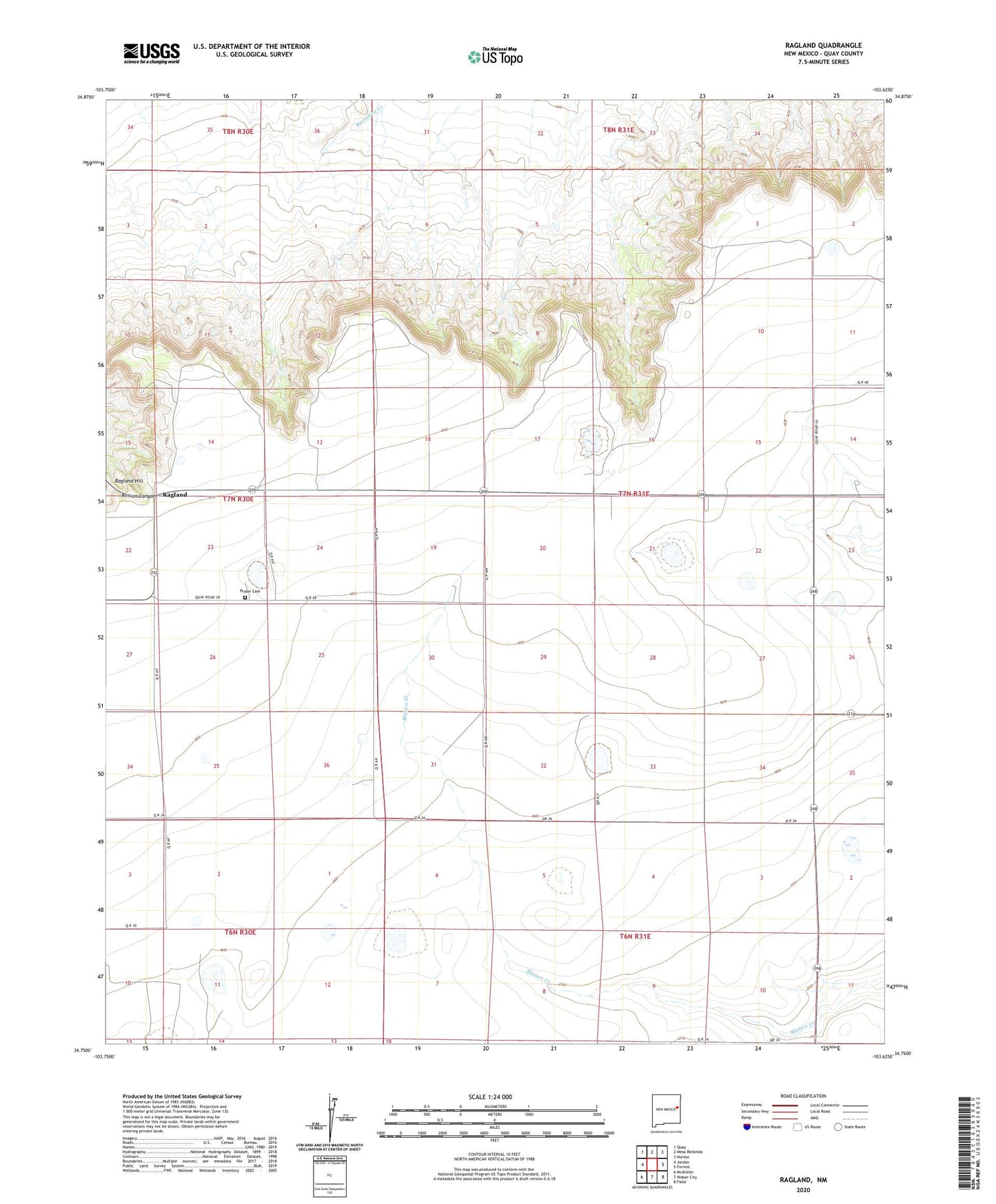
2023 topographic map quadrangle Ragland in the state of New Mexico. Scale: 1:24000. Based on the newly updated USGS 7.5' US Topo map series, this map is in the following counties: Quay. The map contains contour data, water features, and other items you are used to seeing on USGS maps, but also has updated roads and other features. This is the next generation of topographic maps. Printed on high-quality waterproof paper with UV fade-resistant inks.
Quads adjacent to this one:
West: Jordan
Northwest: Quay
North: Mesa Redonda
Northeast: Norton
East: Forrest
Southeast: Field
South: Weber City
Southwest: McAlister
This map covers the same area as the classic USGS quad with code o34103g6.
Contains the following named places: Frio Post Office, Kirk, Prater Cemetery, Ragland, Ragland Hill, Ragland Post Office, Ragland Weather Station, Rush, Stewart