MyTopo
Obar New Mexico US Topo Map
Couldn't load pickup availability
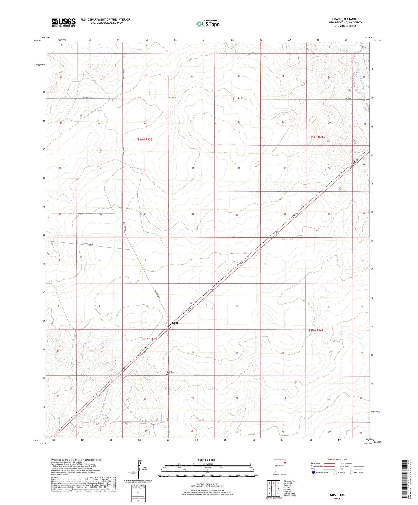
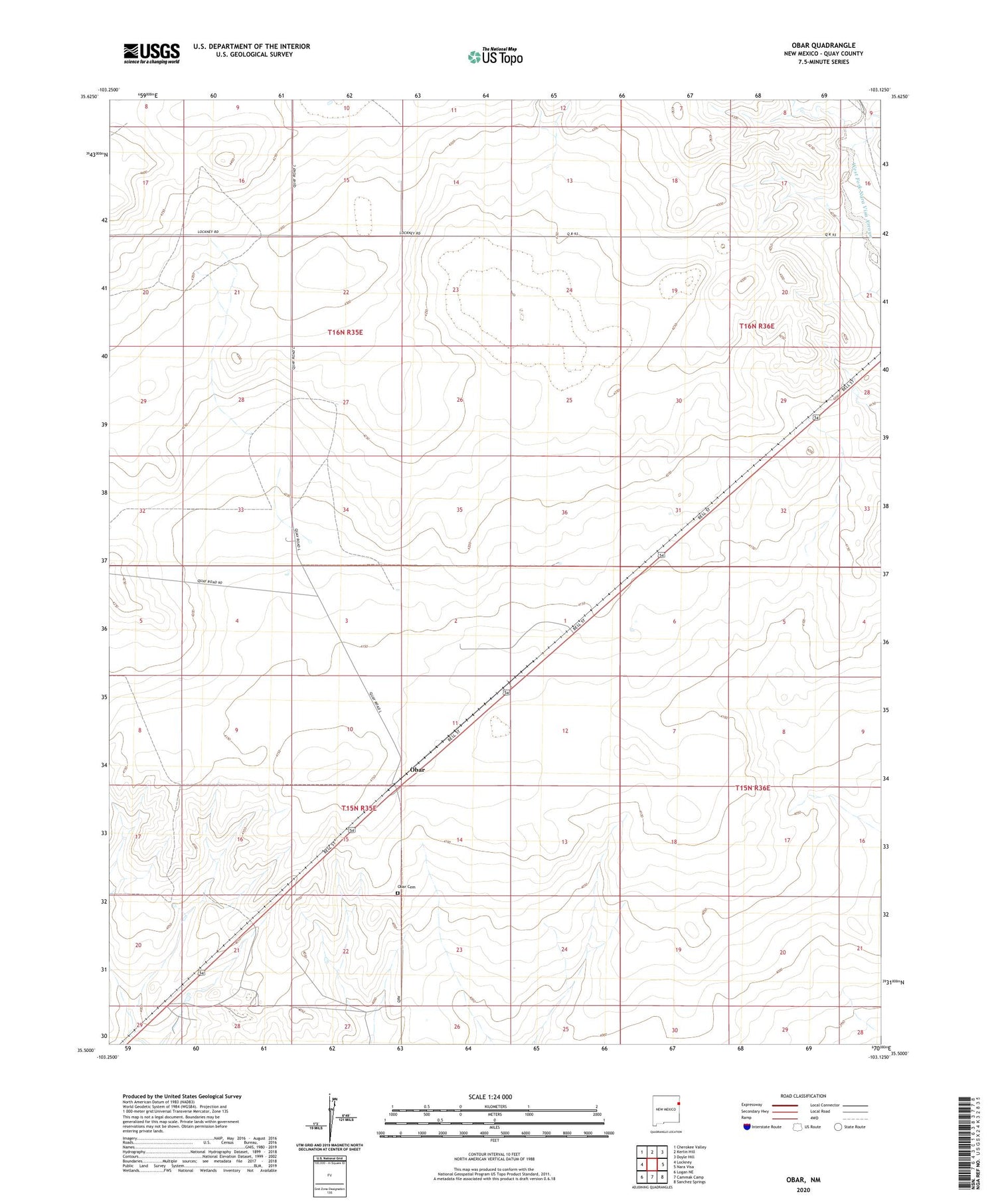
2020 topographic map quadrangle Obar in the state of New Mexico. Scale: 1:24000. Based on the newly updated USGS 7.5' US Topo map series, this map is in the following counties: Quay. The map contains contour data, water features, and other items you are used to seeing on USGS maps, but also has updated roads and other features. This is the next generation of topographic maps. Printed on high-quality waterproof paper with UV fade-resistant inks.
Quads adjacent to this one:
West: Lockney
Northwest: Cherokee Valley
North: Kerlin Hill
Northeast: Doyle Hill
East: Nara Visa
South: Cammak Camp
Southwest: Logan NE
Contains the following named places: 00515 Water Well, 05264 Water Well, 05267 Water Well, 05269 Water Well, 05270 Water Well, 05272 Water Well, 05273 Water Well, 05299 Water Well, 05300 Water Well, 05301 Water Well, 05307 Water Well, 05309 Water Well, 05315 Water Well, 05454 Water Well, 05466 Water Well, 05476 Water Well, 05478 Water Well, 88430, Allen Well, Berlin Well, Bullock, Burkhart Well, Busick Well, Camp Well, Cross Track Well, Gravel Pit, Haney Well, Hughs, Johann Well, Logan-Nara Visa Division, Nelson, Nelson Well, North Well, Obar, Obar Cemetery, Obar Post Office, Obar Weather Station, Railroad Well, Roocol Well, Section Well, South Well, Stringfellow Well, White Well