MyTopo
Oil Center New Mexico US Topo Map
Couldn't load pickup availability
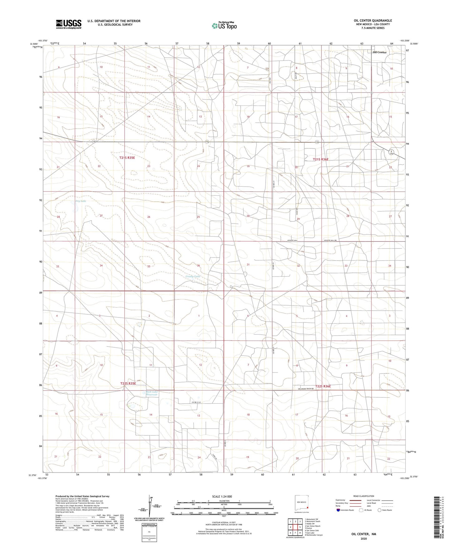
2023 topographic map quadrangle Oil Center in the state of New Mexico. Scale: 1:24000. Based on the newly updated USGS 7.5' US Topo map series, this map is in the following counties: Lea. The map contains contour data, water features, and other items you are used to seeing on USGS maps, but also has updated roads and other features. This is the next generation of topographic maps. Printed on high-quality waterproof paper with UV fade-resistant inks.
Quads adjacent to this one:
West: San Simon Ranch
Northwest: Monument SW
North: Monument South
Northeast: Hobbs SW
East: Eunice
Southeast: Rattlesnake Canyon
South: East Lake
Southwest: San Simon Sink
This map covers the same area as the classic USGS quad with code o32103d3.
Contains the following named places: 10575 Water Well, 10576 Water Well, 10577 Water Well, 10578 Water Well, 88231, Amerada Well, Closson Well, Dry Lake, Gypsy Well, Kily Well, Knowles Well, Murphy Tank, North Lake, Oil Center, Phillips Well, Rock Lake Reservoir, Scharbrough Well, Sheep Tank, Shell Well, Star Well, Urssey Tank, White Tank