MyTopo
Ortega Tank New Mexico US Topo Map
Couldn't load pickup availability
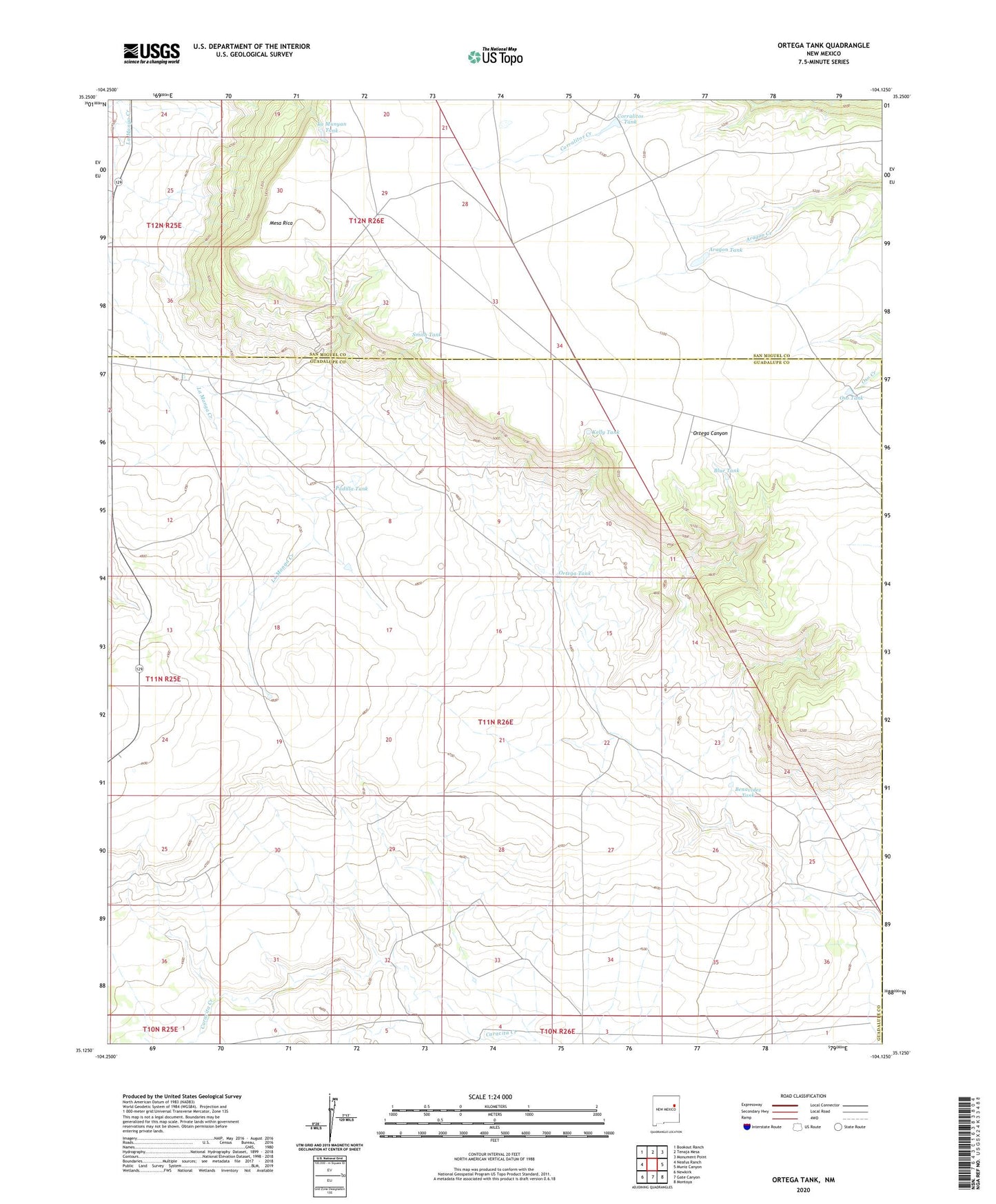
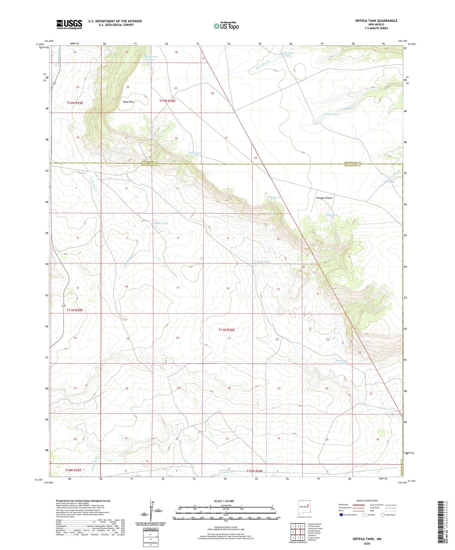
2020 topographic map quadrangle Ortega Tank in the state of New Mexico. Scale: 1:24000. Based on the newly updated USGS 7.5' US Topo map series, this map is in the following counties: Guadalupe, San Miguel. The map contains contour data, water features, and other items you are used to seeing on USGS maps, but also has updated roads and other features. This is the next generation of topographic maps. Printed on high-quality waterproof paper with UV fade-resistant inks.
Quads adjacent to this one:
West: Neafus Ranch
Northwest: Bookout Ranch
North: Tenaja Mesa
Northeast: Monument Point
East: Muniz Canyon
Southeast: Montoya
South: Gate Canyon
Southwest: Newkirk
Contains the following named places: Amy Windmill, Aragon Dam, Aragon Tank, Benavidez Tank, Benavidez Windmill, Blue Tank, Corralitos Tank, Correo Post Office, Kelly Tank, La Munyan Tank, Mesa Rica, Mitchell Windmill, Morris Windmills, Ortega Tank, Ortega Windmills, Oso Tank, Padilla Tank, Smith Tank, Tarkington Windmill