MyTopo
Muniz Canyon New Mexico US Topo Map
Couldn't load pickup availability
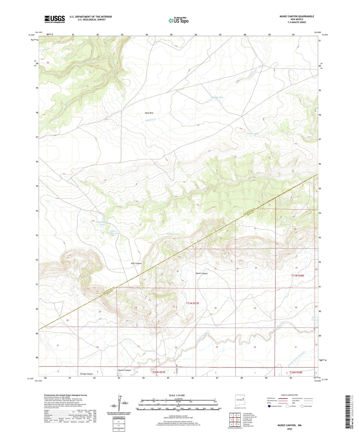
2023 topographic map quadrangle Muniz Canyon in the state of New Mexico. Scale: 1:24000. Based on the newly updated USGS 7.5' US Topo map series, this map is in the following counties: San Miguel, Quay, Guadalupe. The map contains contour data, water features, and other items you are used to seeing on USGS maps, but also has updated roads and other features. This is the next generation of topographic maps. Printed on high-quality waterproof paper with UV fade-resistant inks.
Quads adjacent to this one:
West: Ortega Tank
Northwest: Tenaja Mesa
North: Monument Point
Northeast: Carpenter Mesa SW
East: Cow Canyon
Southeast: Quemado Hills
South: Montoya
Southwest: Gate Canyon
This map covers the same area as the classic USGS quad with code o35104b1.
Contains the following named places: Aragon Creek, Bull Canyon Creek, Church Windmill, Donne Windmills, Duwess Canyon, Duwess Windmill, Feed Pasture Tank, Horse Pasture Tank, Horton Tank, Little Church Windmill, Mesa Rica Camp, Middle Tank, Muniz Canyon, Muniz Tank, Oil Well Windmill, Oso Windmill, Smith Windmill, Twin Windmills