MyTopo
Pinavete Canyon New Mexico US Topo Map
Couldn't load pickup availability
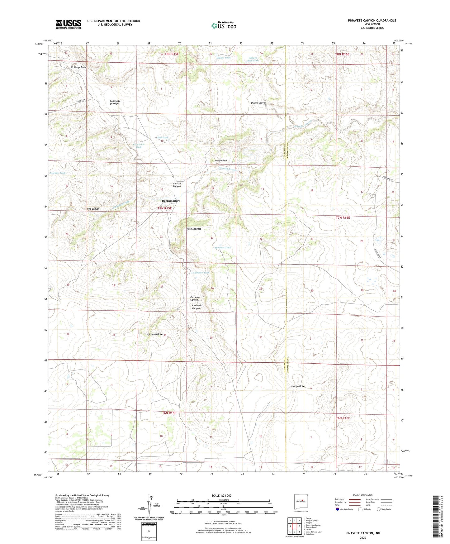
2023 topographic map quadrangle Pinavete Canyon in the state of New Mexico. Scale: 1:24000. Based on the newly updated USGS 7.5' US Topo map series, this map is in the following counties: Torrance, Guadalupe. The map contains contour data, water features, and other items you are used to seeing on USGS maps, but also has updated roads and other features. This is the next generation of topographic maps. Printed on high-quality waterproof paper with UV fade-resistant inks.
Quads adjacent to this one:
West: Santo Nino Canyon
Northwest: Palma
North: Milagro Spring
Northeast: Milagro
East: George Ranch
Southeast: Mesa Leon
South: Santa Barbara Lake
Southwest: Encino
This map covers the same area as the classic USGS quad with code o34105g3.
Contains the following named places: Apodaca Tank, Armijo Peak, Canoncito de Milpa, Carneros Canyon, Carneros Draw, Carrizo Canyon, Chavez Red Tank, Demesio Tank, Derramadero, Diablo Canyon, Diablo Tank, El Marge Draw, Mesa Apodaca, Pinavetito Canyon, Prudencia Tank, Red Canyon, Red Tank