
MyTopo
Point of Rocks Mesa New Mexico US Topo Map
Couldn't load pickup availability
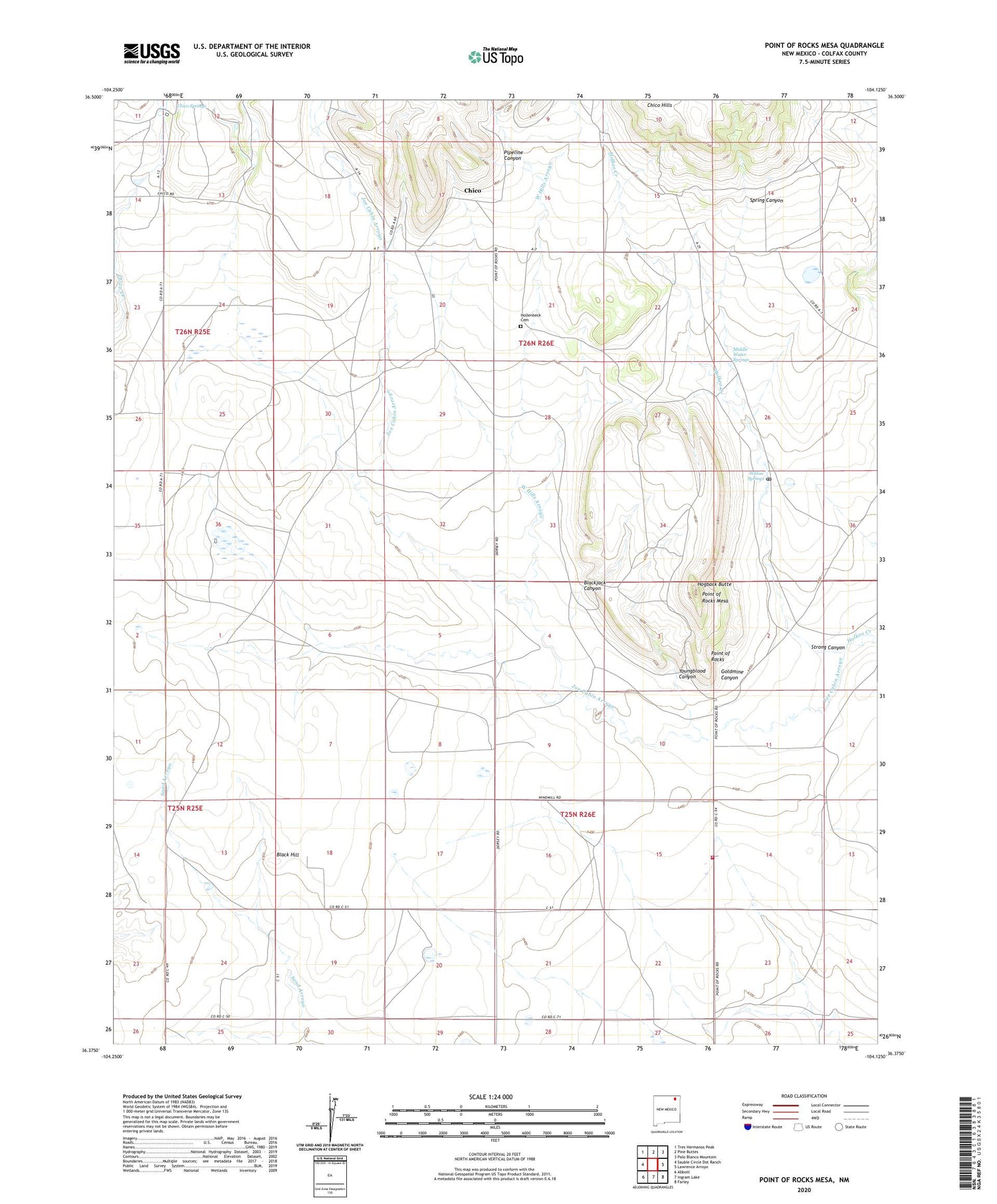
2020 topographic map quadrangle Point of Rocks Mesa in the state of New Mexico. Scale: 1:24000. Based on the newly updated USGS 7.5' US Topo map series, this map is in the following counties: Colfax. The map contains contour data, water features, and other items you are used to seeing on USGS maps, but also has updated roads and other features. This is the next generation of topographic maps. Printed on high-quality waterproof paper with UV fade-resistant inks.
Quads adjacent to this one:
West: Sauble Circle Dot Ranch
Northwest: Tres Hermanos Peak
North: Pine Buttes
Northeast: Palo Blanco Mountain
East: Lawrence Arroyo
Southeast: Farley
South: Ingram Lake
Southwest: Abbott
Contains the following named places: Black Hill, Blackjack Canyon, Chico, Chico Post Office, Chico Springs, Colfax County Fire Department District 4 Farley Substation, Coulter Well, Dorsey Mansion State Monument, Goldmine Canyon, Halliwell Well, Hinston, Hogback Butte, Hollenbeck Cemetery, Joe Cabin Arroyo, Jones Well, McBride Well, McConnell, Mexican Lake, Middle Water Springs, Middle Well, Pacheco Well, Petty Well, Pipeline Canyon, Point of Rocks, Point of Rocks Historical Marker, Point of Rocks Mesa, Rector Well, Rocky Arroyo, Roundtree, Roundtree Ranch, Santa Fe Trail, Seward Lake, Spring Canyon, Strong Canyon, View of the Rocks Historical Marker, West Hills Arroyo, Wheatland Well, Willow Springs, Willow Springs Historical Marker, Willow Springs Post Office, Youngblood Canyon


