MyTopo
Tres Hermanos Peak New Mexico US Topo Map
Couldn't load pickup availability
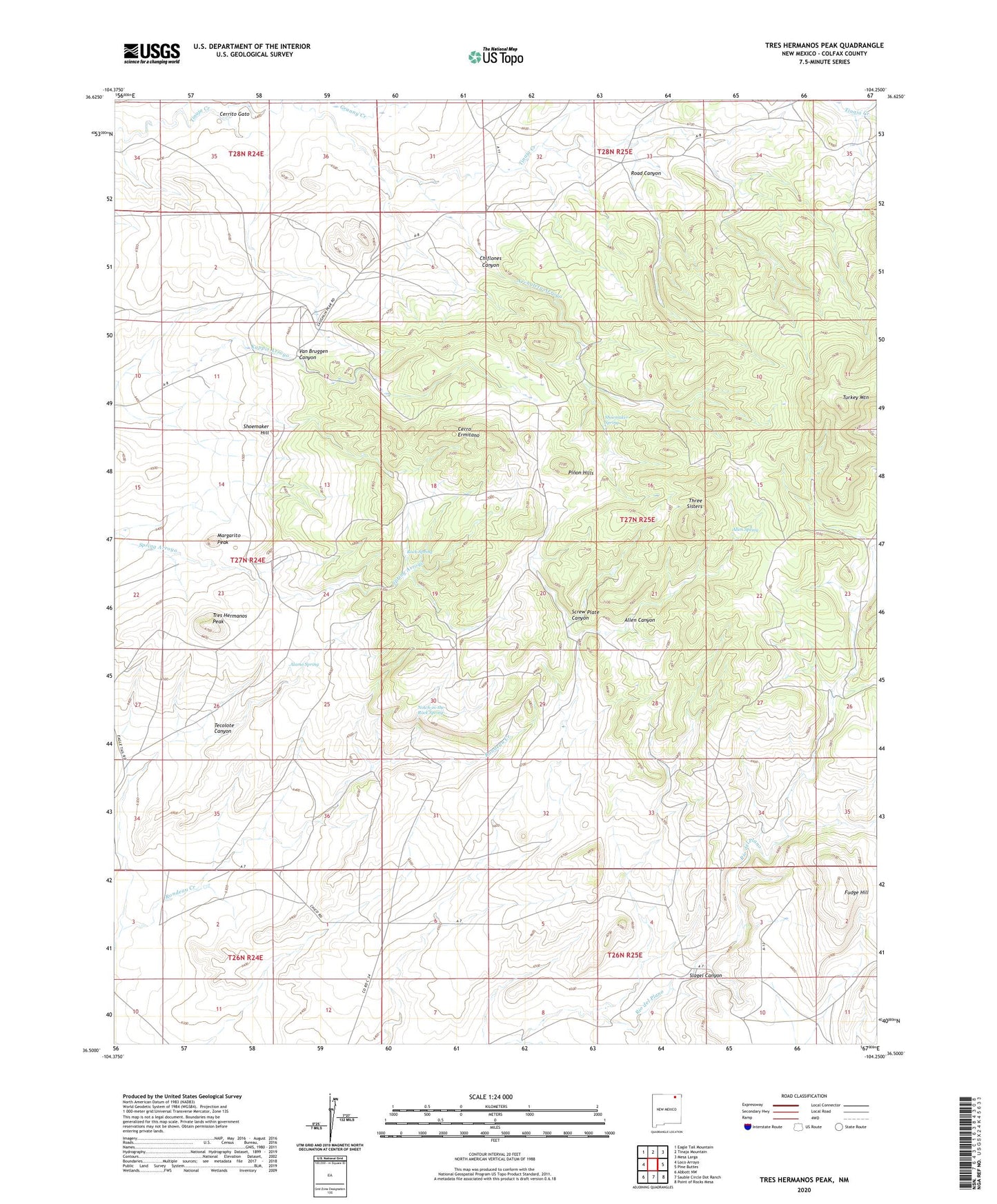
2023 topographic map quadrangle Tres Hermanos Peak in the state of New Mexico. Scale: 1:24000. Based on the newly updated USGS 7.5' US Topo map series, this map is in the following counties: Colfax. The map contains contour data, water features, and other items you are used to seeing on USGS maps, but also has updated roads and other features. This is the next generation of topographic maps. Printed on high-quality waterproof paper with UV fade-resistant inks.
Quads adjacent to this one:
West: Loco Arroyo
Northwest: Eagle Tail Mountain
North: Tinaja Mountain
Northeast: Mesa Larga
East: Pine Buttes
Southeast: Point of Rocks Mesa
South: Sauble Circle Dot Ranch
Southwest: Abbott NW
This map covers the same area as the classic USGS quad with code o36104e3.
Contains the following named places: Alamo Spring, Allen Canyon, Allen Spring, Archuleta Arroyo, Cerrito Gato, Cerro Ermitano, Chiflones Canyon, Fudge Hill, Garcia Windmill, Granny Creek, Margarito Peak, Montoya, Moore Windmill, Neill 3 Sauble, Notch-in-the-Rock Spring, Pinon Hills, Road Canyon, Rock Spring, Roundtree, Screw Plate Canyon, Shell Prospect, Shoemaker Hill, Shoemaker Spring, Slagel Canyon, Tecolote Canyon, Three Sisters, Tres Hermanos Peak, Turkey Mountain, Van Bruggen Canyon, York 1 Tex-Mex