MyTopo
Potrillo Hill New Mexico US Topo Map
Couldn't load pickup availability
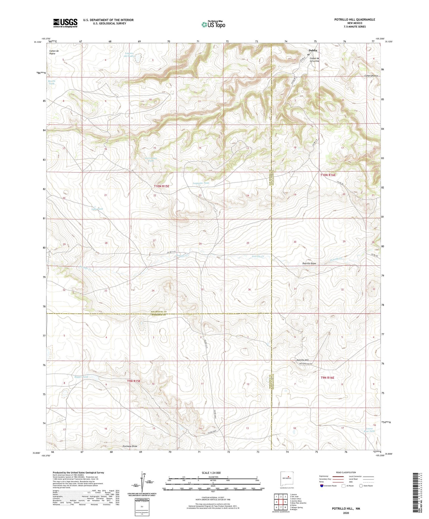
2020 topographic map quadrangle Potrillo Hill in the state of New Mexico. Scale: 1:24000. Based on the newly updated USGS 7.5' US Topo map series, this map is in the following counties: San Miguel, Guadalupe, Torrance. The map contains contour data, water features, and other items you are used to seeing on USGS maps, but also has updated roads and other features. This is the next generation of topographic maps. Printed on high-quality waterproof paper with UV fade-resistant inks.
Quads adjacent to this one:
West: Jacinto Mesa
Northwest: Aurora
North: San Juan
Northeast: Anton Chico
East: Mesa Palo Amarillo
Southeast: Milagro
South: Milagro Spring
Southwest: Palma
Contains the following named places: Big Tank, Bigger Tank, Canada los Rincones, Canon de la Luvina, Dahlia, Dahlia Post Office, Dahlia School, East Tank, Lake Tank, Laquna del Padre, Laqunita Tank, Larranaga Tank, Little West Tank, Lower East Tank, Martinez Ranch, McKenzie Ranch, Perez Ranch, Potrillo Draw, Potrillo Hill, Potrillo Tank, Sanchez Ranch, Thompson Ranch, Upper East Tank