MyTopo
Jacinto Mesa New Mexico US Topo Map
Couldn't load pickup availability
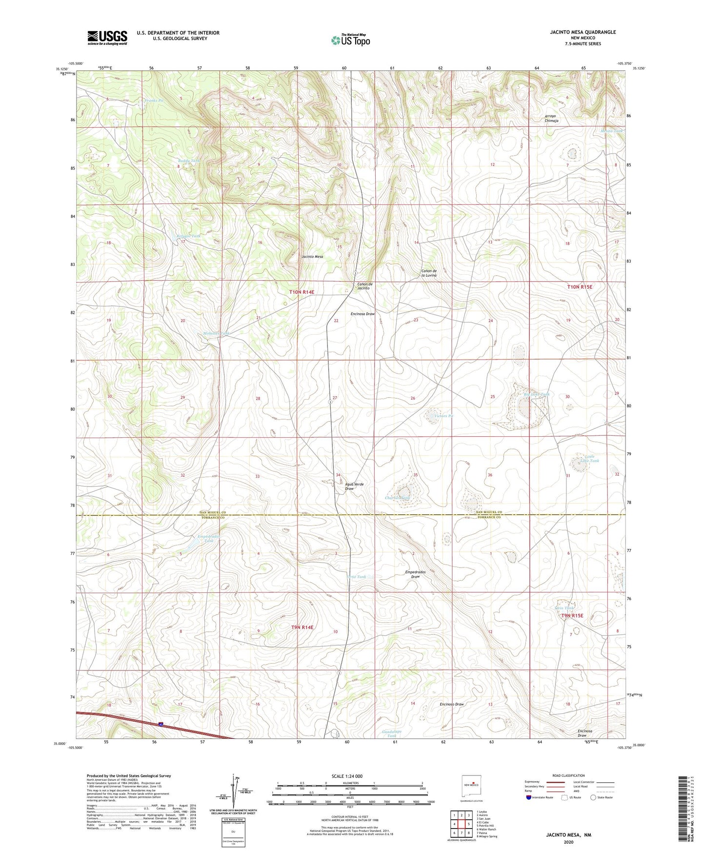
2023 topographic map quadrangle Jacinto Mesa in the state of New Mexico. Scale: 1:24000. Based on the newly updated USGS 7.5' US Topo map series, this map is in the following counties: San Miguel, Torrance. The map contains contour data, water features, and other items you are used to seeing on USGS maps, but also has updated roads and other features. This is the next generation of topographic maps. Printed on high-quality waterproof paper with UV fade-resistant inks.
Quads adjacent to this one:
West: El Cabo
Northwest: Leyba
North: Aurora
Northeast: San Juan
East: Potrillo Hill
Southeast: Milagro Spring
South: Palma
Southwest: Waller Ranch
This map covers the same area as the classic USGS quad with code o35105a4.
Contains the following named places: Agua Verde Draw, Agua Verde Ranch, Big Lake Tank, Buddy Tank, Charlies Tank, Empedrados Draw, Empedrados Tank, Encinoso Draw, Franks Pit, Jacinto Mesa, Laguna del Sauino, Little Lake Tank, Loving Tank, Mesita Tank, Molasses Tank, New Well, Nicholas Tank, Ortiz Tank, Refugio Tank, Sheep Camp Tank, Trujillo Ranch, Twin Tank, Victors Pit, West Tank