MyTopo
Mesa Palo Amarillo New Mexico US Topo Map
Couldn't load pickup availability
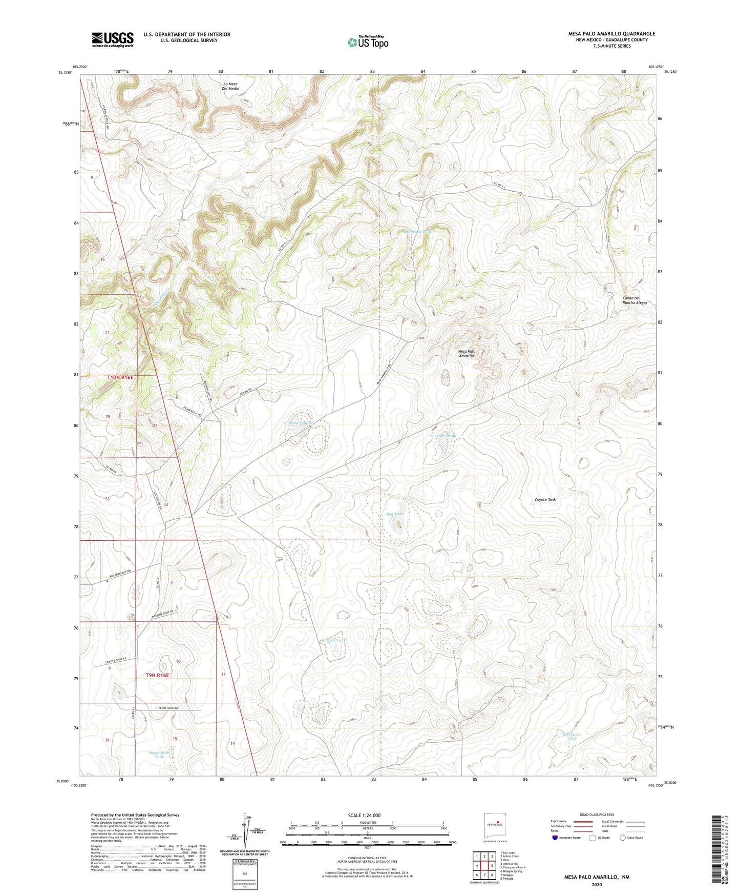
2023 topographic map quadrangle Mesa Palo Amarillo in the state of New Mexico. Scale: 1:24000. Based on the newly updated USGS 7.5' US Topo map series, this map is in the following counties: Guadalupe. The map contains contour data, water features, and other items you are used to seeing on USGS maps, but also has updated roads and other features. This is the next generation of topographic maps. Printed on high-quality waterproof paper with UV fade-resistant inks.
Quads adjacent to this one:
West: Potrillo Hill
Northwest: San Juan
North: Anton Chico
Northeast: Dilia
East: Thompson Ranch
Southeast: Pintada
South: Milagro
Southwest: Milagro Spring
This map covers the same area as the classic USGS quad with code o35105a2.
Contains the following named places: Antelope Tank, Bills Tank, Catfish Tank, Coyote Tank, Cuervo Tank, Dahlia Pumping Station, Draw Tank, Duran Tank, Holbrook Tank, Laguna Quates, Marquez Ranch, Mesa Palo Amarillo, Middle Tanks, New Tank, New Windmill, Potrillo Creek, Puertico Tank, Red Lake, Secundino Tank, Secundino Windmill, Spring Tank, Starve-Out Trap, Streetcar Tank, Thompson Tank, Vigil Tank