MyTopo
Prairieview NE New Mexico US Topo Map
Couldn't load pickup availability
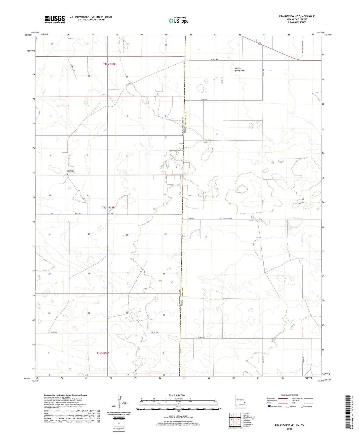
2023 topographic map quadrangle Prairieview NE in the states of New Mexico, Texas. Scale: 1:24000. Based on the newly updated USGS 7.5' US Topo map series, this map is in the following counties: Lea, Yoakum. The map contains contour data, water features, and other items you are used to seeing on USGS maps, but also has updated roads and other features. This is the next generation of topographic maps. Printed on high-quality waterproof paper with UV fade-resistant inks.
Quads adjacent to this one:
West: Prairieview NW
Northwest: Gladiola
Northeast: Two B Ranch SW
East: Plains NW
Southeast: Ink Basin
Southwest: Prairieview
Contains the following named places: Boardman Windmill, Bronco Oil Field, East Townsend Windmill, East Windmill, Floyd Windmill, House Trap Windmill, Koch Windmill, Murphys Chapel Cemetery, Mutt Windmill, North Townsand Windmill, Rogers Windmill