MyTopo
Progresso New Mexico US Topo Map
Couldn't load pickup availability
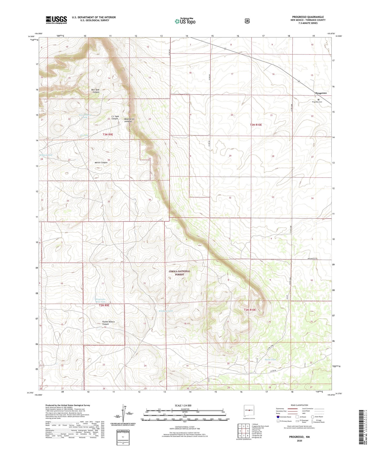
2020 topographic map quadrangle Progresso in the state of New Mexico. Scale: 1:24000. Based on the newly updated USGS 7.5' US Topo map series, this map is in the following counties: Torrance. The map contains contour data, water features, and other items you are used to seeing on USGS maps, but also has updated roads and other features. This is the next generation of topographic maps. Printed on high-quality waterproof paper with UV fade-resistant inks.
Quads adjacent to this one:
West: Round Top
Northwest: Willard
North: Laguna Del Perro South
Northeast: Rattlesnake Hill
East: Progresso NE
Southeast: Progresso SE
South: Progresso SW
Southwest: Gran Quivira
Contains the following named places: Bell Tank, Brown Ranch, CC Tank, Chalk Hill Well, D Devaney Ranch, DeVaney Ranch, East Willard Tank, Garcia Windmill, Garden Windmill, Hansen Ranch, Houston Windmill, Jew Windmill, Mesa de los Jumanos, Mountainair Ranger District, Niemi Ranch, North Gora Well, Piggott Ranch, Powerline Tank, Progresso, Progresso Cemetery, Progresso Post Office, Progresso Weather Station, Progresso West Tank, Ruins Tank, Ruins Windmill, Tabira Ruin, Wiltbank Tank, Wiltbank Windmill