MyTopo
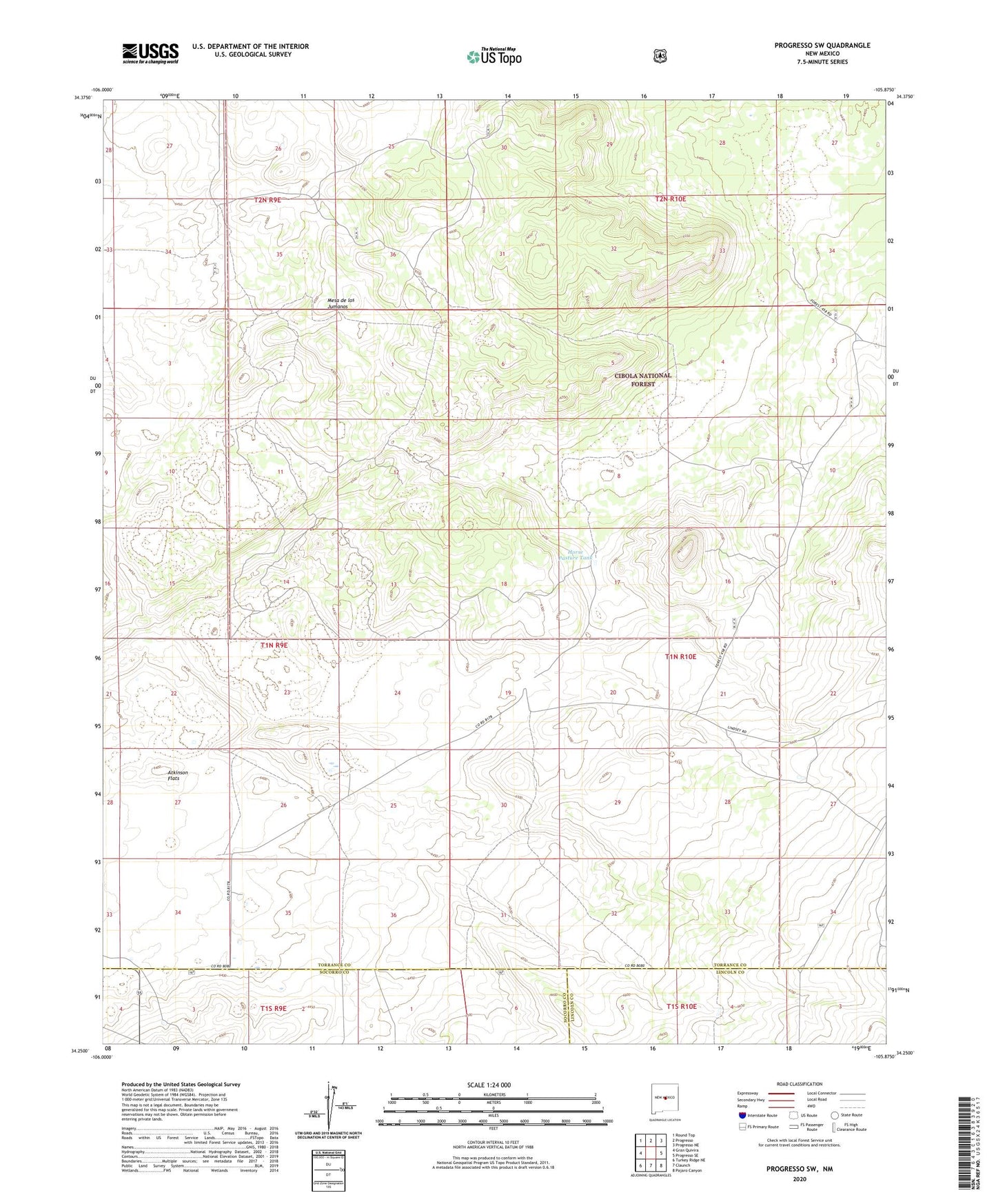
Progresso SW New Mexico US Topo Map
Couldn't load pickup availability
Also explore the Progresso SW Forest Service Topo of this same quad for updated USFS data
2023 topographic map quadrangle Progresso SW in the state of New Mexico. Scale: 1:24000. Based on the newly updated USGS 7.5' US Topo map series, this map is in the following counties: Torrance, Socorro, Lincoln. The map contains contour data, water features, and other items you are used to seeing on USGS maps, but also has updated roads and other features. This is the next generation of topographic maps. Printed on high-quality waterproof paper with UV fade-resistant inks.
Quads adjacent to this one:
West: Gran Quivira
Northwest: Round Top
North: Progresso
Northeast: Progresso NE
East: Progresso SE
Southeast: Pajaro Canyon
South: Claunch
Southwest: Turkey Ridge NE
This map covers the same area as the classic USGS quad with code o34105c8.
Contains the following named places: Atkinson Flats, Atkinson Ranch, Atkinson Well, Atkinson Windmill, Axtell Well, Dempster Well, Horse Pasture Tank, Mesa De Los Jumanos Ruins, Mesa Trick Tank, Middle Well, North Well, South Tank, Three Way Windmill, Wire Lake