
MyTopo
Pueblo Bonito New Mexico US Topo Map
Couldn't load pickup availability
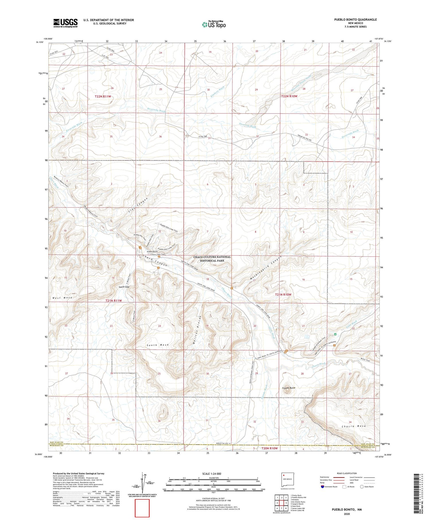
2020 topographic map quadrangle Pueblo Bonito in the state of New Mexico. Scale: 1:24000. Based on the newly updated USGS 7.5' US Topo map series, this map is in the following counties: San Juan, McKinley. The map contains contour data, water features, and other items you are used to seeing on USGS maps, but also has updated roads and other features. This is the next generation of topographic maps. Printed on high-quality waterproof paper with UV fade-resistant inks.
Quads adjacent to this one:
West: Kin Klizhin Ruins
Northwest: Pretty Rock
North: Pueblo Bonito NW
Northeast: Kimbeto
East: Sargent Ranch
Southeast: Seven Lakes NE
South: Seven Lakes NW
Southwest: Nose Rock
Contains the following named places: 15R-307 Water Well, Alto Chjiquito, Alto Grande, Betonnie Tsosie Wash, Casa Chiquita, Casa Rinconada, CC Kernodle Number 1 Water Well, Chaco Canyon, Chaco Canyon Trading Post, Chaco Canyon Weather Station, Chaco Culture National Historical Park, Chaco Post Office, Chettro Kettle, Clys Canyon, Fajada Butte, Fajada Wash, Gallo Campground, Gallo Wash, Heshoda Bitsulliya, Hungo Pavie, Kimbeto Wash, Kin Kletso, Kin Nahasbasd, Mockingbird Canyon, Pueblo Alto, Pueblo Bonito, Pueblo Bonito Ranger Station, Pueblo del Arroyo, Putnam, Putnam Post Office, South Gap, South Mesa, Tsin Kletzin, Una Vida, Weritos Rincon, West Mesa, Wetherill Cemetery, Willeto Well, Yazzi Well


