MyTopo
Kin Klizhin Ruins New Mexico US Topo Map
Couldn't load pickup availability
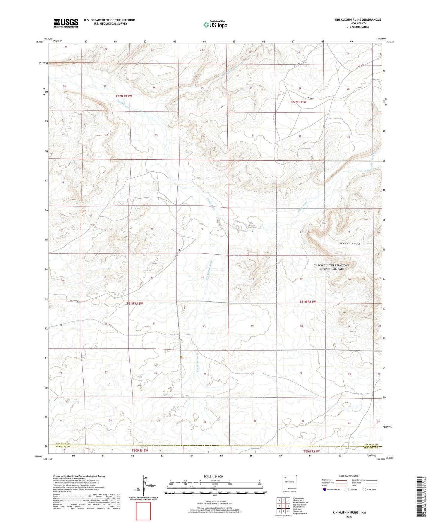
2023 topographic map quadrangle Kin Klizhin Ruins in the state of New Mexico. Scale: 1:24000. Based on the newly updated USGS 7.5' US Topo map series, this map is in the following counties: San Juan, McKinley. The map contains contour data, water features, and other items you are used to seeing on USGS maps, but also has updated roads and other features. This is the next generation of topographic maps. Printed on high-quality waterproof paper with UV fade-resistant inks.
Quads adjacent to this one:
West: La Vida Mission
Northwest: Tanner Lake
North: Pretty Rock
Northeast: Pueblo Bonito NW
East: Pueblo Bonito
Southeast: Seven Lakes NW
South: Nose Rock
Southwest: Milk Lake
This map covers the same area as the classic USGS quad with code o36108a1.
Contains the following named places: 15T-536 Water Well, Ah-shi-sle-pah Wash, Beyale Well, CCR Number 12 Water Well, CCR-2 Water Well, Chaco Culture National Historic Park Historical Marker, Chaco Wash, Escavada Wash, Kin Klizhin, Kin Klizhin Wash, Padilla Well, Penasco Blanco